Mt. Shinmoedake located at the prefectural border of Kagoshima and Miyazaki has erupted since October 11, 2017.
Fig. 1 shows the volcanic smoke observed by TANSO-CAI on October 9 before eruption and at 1:37 pm on October 12 after eruption with the enlarged figure around the Mt. Shinmoedake. Fig. 2 is an image taken from the monitor camera mounted on TANSO-FTS at 1:37 pm on October 12. The red mark shows the location of Mt. Shinmoedake. These images of October 12 show that the volcanic smoke rose up to northeast from Mt. Shinmoedake. The CAI image has dark colored area along the volcanic smoke. It might be the volcanic ash fall area.
Japan Meteorological Agency alerted the volcanic warning Level 3 on October 19, and required continuous cautions.
※The TANSO-CAI image was composed of band2 (674nm) in red, band3 (870nm) in green and band1 (380nm) in blue.

Fig.1. Before and after the eruption of Shinmoedake. The red mark shows the location of the mountain.
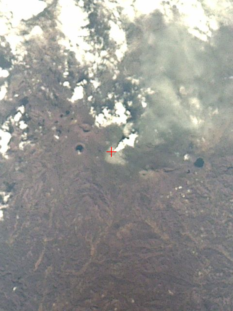
Fig.2 Monitor camera image capturing volcanic smoke from Mt. Shinmoedake.
Related article:Japan Meteorological Agency Volcanic Warnings(Kyushu)
