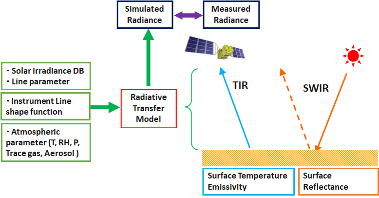
The Spectral radiances at the top of the atmosphere (TOA) is calculated using radiative transfer code with accurate database.
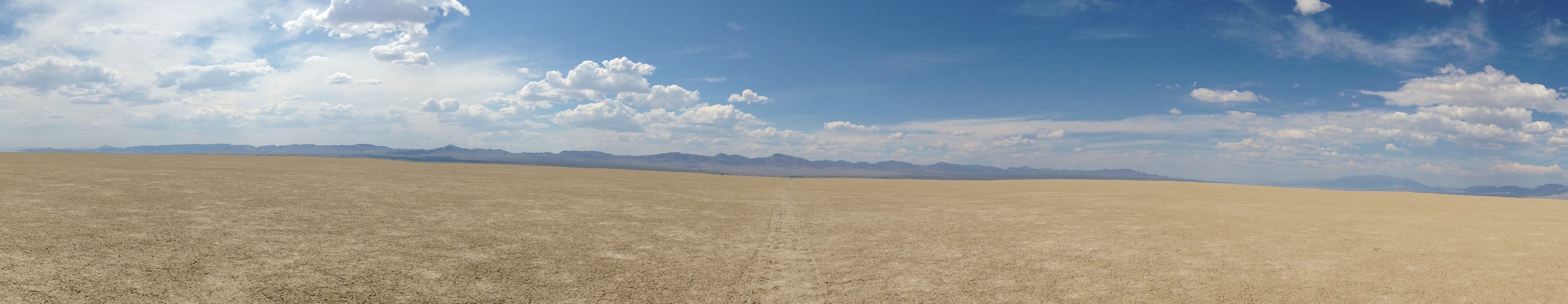
The RRV playa is one of the Central Nevada Desert Basins in the Tonopah Basin and is approximately 80 miles long north-south and up to 20 miles wide , with some southern areas running southwest to northeast.
Each sensor has a different spatial resolution.
| Nadir footprint size | |
|---|---|
| GOSAT | Circle of 10.5km diameter |
| GOSAT-2 | Circle of 9.6km diameter |
| OCO-2 | Rectangle of 1.3 km * 2.3 km |
| OCO-3 | Rectangle of 1.6 km * 2.2 km |
| TROPOMI | Rectangle of 3.5 km * 5.5 km (B6) 7 km * 5.5 km (B7, B8) |
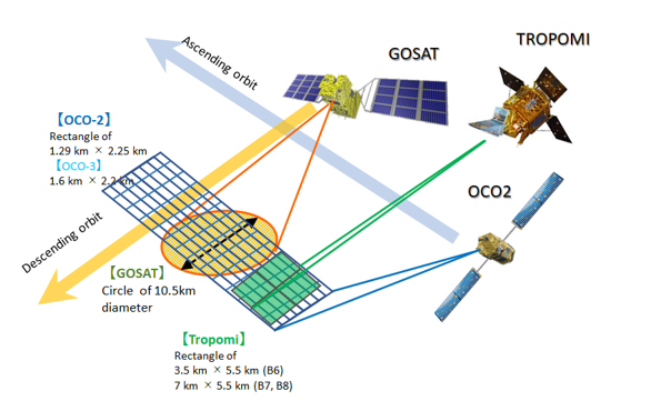
Depending on the sensor, the observation footprint size is different. Considering the variability of the surface reflectance within a footprint is an important point.
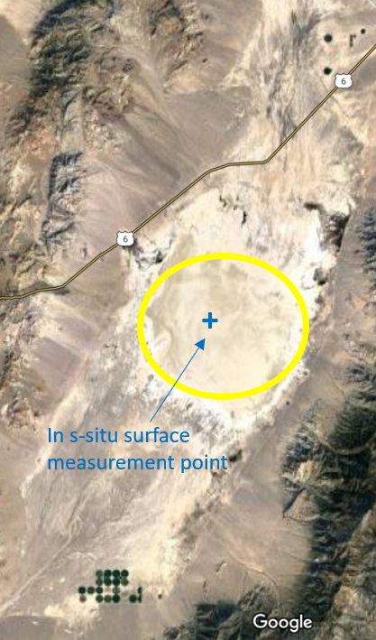
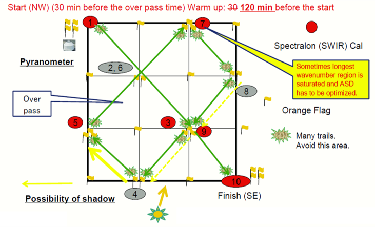
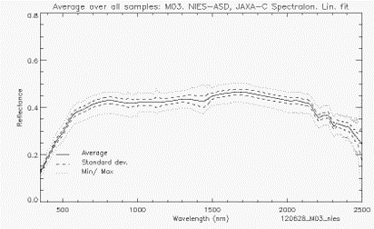
In the campaign, the surface reflectance is measured with spectrometer within a 500mx500m rectangle. The measurement wavelength is 400 to 2500 nm.
In order to extend the measured ground surface reflectance to the footprint of the satellite, it is effective to use the nadir surface reflectance product (Kuze et. al., 2011).
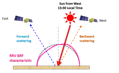
The RRV surface reflectance is Non-Lambertian. The surface BRF characteristics depends on the satellite - solar - ground geometry. It is effective to use the surface BRDF model parameters products.
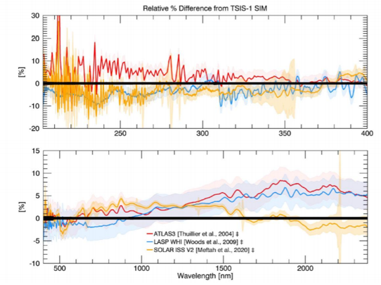
The solar database is one of the most important elements of vicarious calibration. The TSIS-HSRS (The Total and Spectral Solar Irradiance Sensor-1 Hybrid Solar Reference Spectrum) is a new solar irradiance reference spectrum.
The vertical profiles of pressure, temperature and relative humidity needed for the radiative transfer calculations. We launched the radio sonde over the playa from the base camp at the time of satellite overpass.

NASA Ames Alpha Jet Atmospheric eXperiment (AJAX) has a long-term record of measurements over Railroad Valley since June 2011. AJAX measures trace gases (CO2, CH4, O3, and H2O) by spiral flight over RRV coincident with satellite overpass.
