Satellite data simulator (Joint-Simulator)
- Top
- Technical development
- Satellite data simulator (Joint Simulator)
Satellite data simulator (Joint Simulator)
The Intergovernmental Panel on Climate Change (IPCC) has pointed out in its report that there are many uncertainties in the treatment of cloud and precipitation processes in numerical climate models used to predict climate change. Therefore, verification of cloud and precipitation processes in climate models by satellite remote sensing observations is becoming increasingly important.
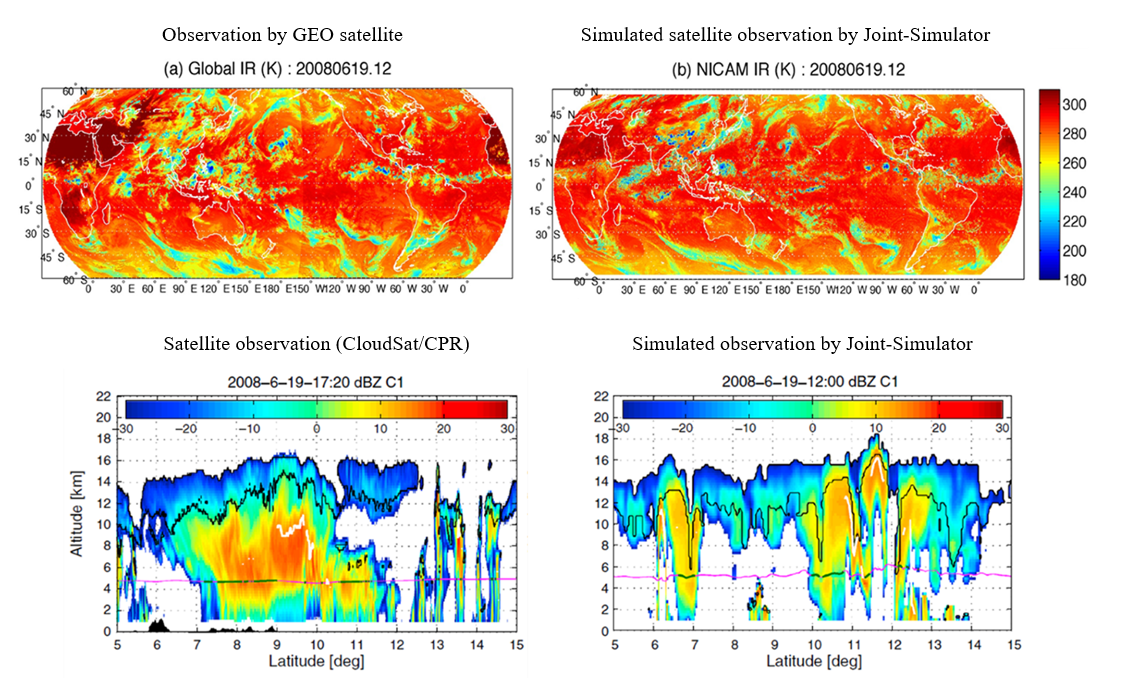
Verifying climate models has used physical quantities estimated from satellite observations, but satellite data simulators have come into use recently. Satellite simulators output pseudo-observation data from satellite sensors from virtual atmospheric data in numerical models, and by comparing and verifying pseudo-observation data with actual observation data, problems in numerical models can be further clarified.
The Joint Simulator for Satellite Sensors is a satellite data simulator being developed jointly by JAXA and the EarthCARE mission and is based on the Satellite Data Simulator Unit (SDSU) (Masunaga et al. 2010, BAMS). The Joint Simulator performs calculations using cloud-resolving numerical meteorological models and global cloud-resolving model data as input. The knowledge gained from its validation will be useful for improving current climate models and developing next-generation climate models. It also helps to improve weather models that forecast daily weather and precipitation.
For more information on the Joint Simulator, please refer to Joint-Simulator@wiki.