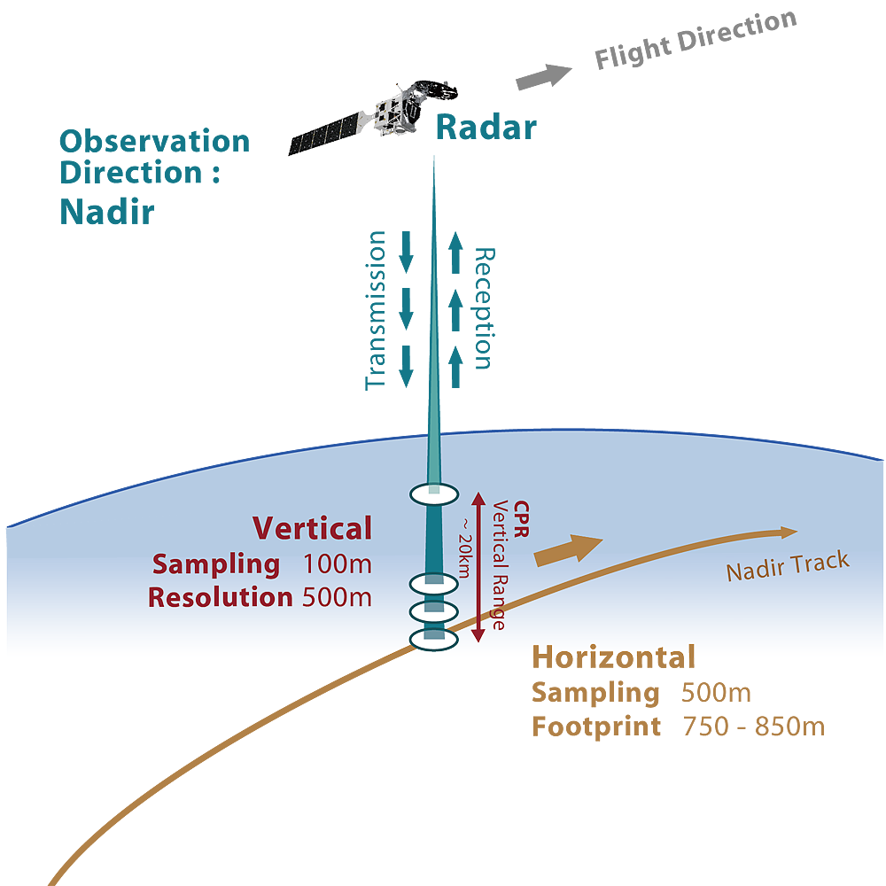
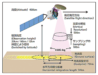
CPR directly measures the intensity and phase information of backscattered signals from clouds and rain, obtained as a vertical profile directly below the satellite. These are corrected by a Level 1 algorithm considering transmission power and receiver gain and converted to values used to obtain the radar reflection factor, Doppler velocity, and Doppler spectrum width. After level 2 processing, such as atmospheric attenuation correction, Doppler fold-back correction, and 1 km and 10 km horizontal integration processing in the propagation path, converting to physical quantities provides estimated cloud mask, water content, ice content, effective particle radius of water and ice clouds, and optical thickness. Estimation algorithms are also being developed for precipitation-related (rain and snow) parameters and atmospheric vertical currents (vertical and settling velocities).
Satellites and Observation Sensors