Data Application Researches
8. Oceanography and Coastal Zone Related Research
Soil Erosion Monitoring in the Huang-He River basin, China by ADEOS AVNIR
8. Oceanography and Coastal Zone Related Research
Soil Erosion Monitoring in the Huang-He River basin, China by ADEOS AVNIR
Soil Erosion Monitoring in the Huang-He River basin, China by ADEOS AVNIR
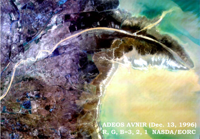
Fig. 1: False color image obtained by ADEOS AVNIR in Dec. 13, 1996
(R, G, B = ch. 3, 2, 1).
(Click to View Enlarged Image)
 This image was produced from data obtained by ADEOS AVNIR in December 13, 1996.
Huang He or the Yellow River, 5,400 km, the second longest river in China, flows from Tibet Heights into Bo Hai, the yellow river-mouth in this image. The river has been benefiting life and sometimes causing disasters.
©JAXA EORC