12. Application Research using Geographical Information
Series of World Heritage from Space / Yakushima
Space Imaging®
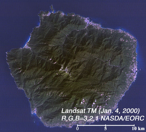
Fig. 1: Image of Yakushima, Japan on Jan. 4, 2000.
(Click to View Enlarged Image)
 This is an image of Yakushima observed on January 4, 2000, by the Thematic Mapper (TM) onboard Landsat-5. Known for its special forest vegetation such as its cedar trees, Yakushima was registered as the World Heritage in December 1993 for the first time in Japan. Along the line from the coast of Yakushima to the top of central mountain (Mt. Miyanoura), the types of vegetation changes from subtropical to warm temperate, temperate, and subalpine. This unique ecosystem, that is continuous changes in vegetation from south to north over just tens of kilometers including giant cedar trees known as Yaku-sugi, has received worldwide acclaim.
The people of Yakushima have a long history of coexistence with forest. They have cut trees in the island over 500 years and use them for resources. On the other hand, they gave the name such as Kigen-sugi (Epoch Cedar), Meoto-sugi (Husband and Wife Cedar), and Daiou-sugi (Royal Cedar) to the huge cedar trees aged over 1,000 years, and preserved them with regard and affection. Currently, Yakushima is inscribed as the national park and strictly preserved as special natural monuments.
Extract from the NASDA Report No. 106, April, 2001
©JAXA EORC