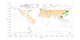
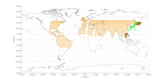
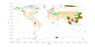
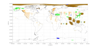
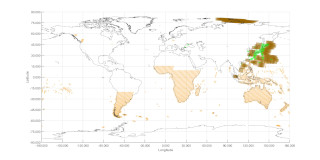
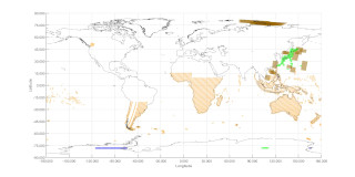
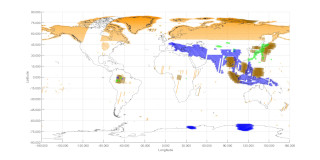
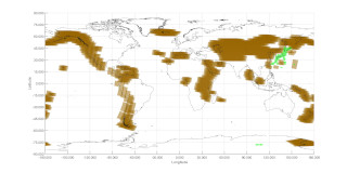
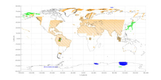
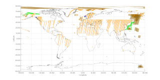
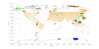
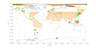
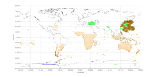
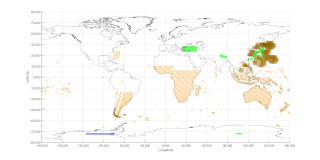
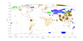
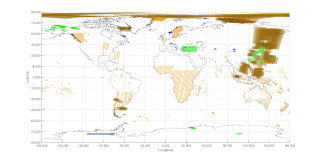
PALSAR-3 Acquisition Plan (v. 3/2026)
Descending
(Day: Localtime 12.00 p.m) paths
ALOS-4 launch: Jul. 1, 2024.
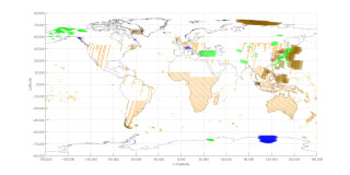
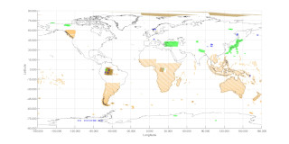
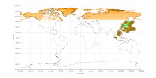
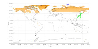
Click on the maps to enlarge.
Note: Coloured polygons indicate regions scheduled for acquisition.
It may be changed due to operation restrictions, emergency observations etc.
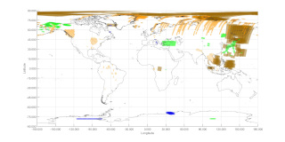 Cycle_18 / 14-Apr.-2025 |
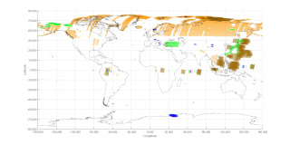 Cycle_19 / 28-Apr.-2025 |
 Cycle_20 / 12-May-2025 |
 Cycle_21 / 26-May-2025 |
 Cycle_22 / 9-Jun.-2025 |
 Cycle_23 / 23-Jun.-2025 |
 Cycle_24 / 7-Jul.-2025 |
 Cycle_25 / 21-Jul.-2025 |
 Cycle_26 / 4-Aug.-2025 |
 Cycle_27 / 18-Aug.-2025 |
 Cycle_28 / 1-Sep.-2025 |
 Cycle_29 / 15-Sep.-2025 |
 Cycle_30 / 29-Sep.-2025 |
 Cycle_31 / 13-Oct.-2025 |
 Cycle_32 / 27-Oct.-2025 |
 Cycle_33 / 10-Nov.-2025 |
 Cycle_34 / 24-Nov.-2025 |
 Cycle_35 / 8-Dec.-2025 |
 Cycle_36 / 22-Dec.-2025 |
 Cycle_37 / 5-Jan.-2026 |
 Cycle_38 / 19-Jan.-2026 |
 Cycle_39 / 2-Feb.-2026 |
 Cycle_40 / 16-Feb.-2026 |
 Cycle_41 / 2-Mar.-2026 |
 Cycle_42 / 16-Mar.-2026 |
 Cycle_43 / 30-Mar.-2026 |
 Cycle_44 / 13-Apr.-2026 |
 Cycle_45 / 27-Apr.-2026 |
 Cycle_46 / 11-May-2026 |
 Cycle_47 / 25-May-2026 |
 Cycle_48 / 08-Jun.-2026 |
 Cycle_49 / 22-Jun.-2026 |
 Cycle_50 / 06-Jul.-2026 |
 Cycle_51 / 20-Jul.-2026 |
 Cycle_52 / 03-Aug.-2026 |
 Cycle_53 / 17-Aug.-2026 |
 Cycle_54 / 31-Aug.-2026 |
 Cycle_55 / 14-Sep.-2026 |
 Cycle_56 / 28-Sep.-2026 |
 Cycle_57 / 12-Oct.-2026 |
| Sensor mode | Sensor Code [Beam No] | Polarization | Off-nadir angle |
|---|---|---|---|
| Stripmap10m 200km swath. | FWD [FWD01-FWD03] |
HH+HV | 3 Beam 28.2°- 44.3°, 41.9°- 48.2° |
| Stripmap6m 100km swath. | HBQ [HBQ06, HBQ08] |
HH+HV+VH+VV | 2 Beam 29.1°- 32.4°, 35.5°- 38.2° |
| Stripmap3m 200km swath. | UWD [UWD01-UWD03] |
HH+HV | 3 Beam 29.1°- 48.0° |
| ScanSAR 700km swath. | XBD [XBD02] |
HH+HV | 4 Scan 39.1° |
| Sensor mode |
|---|
| Stripmap10m 200km swath. |
| Stripmap6m 100km swath. |
| Stripmap3m 200km swath. |
| ScanSAR 700km swath. |