Seen from Space 2009
Prague: The City of a Hundred Spires
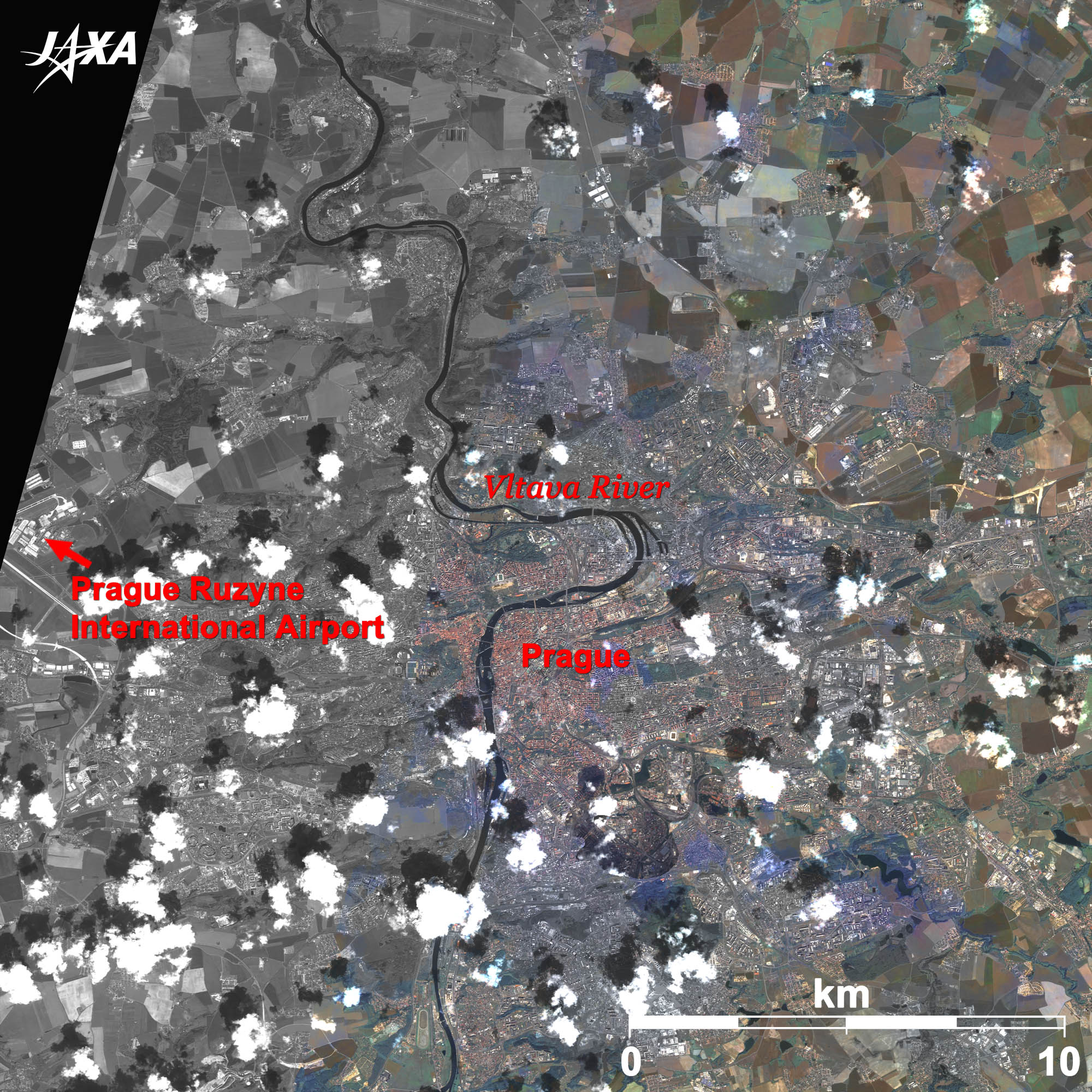 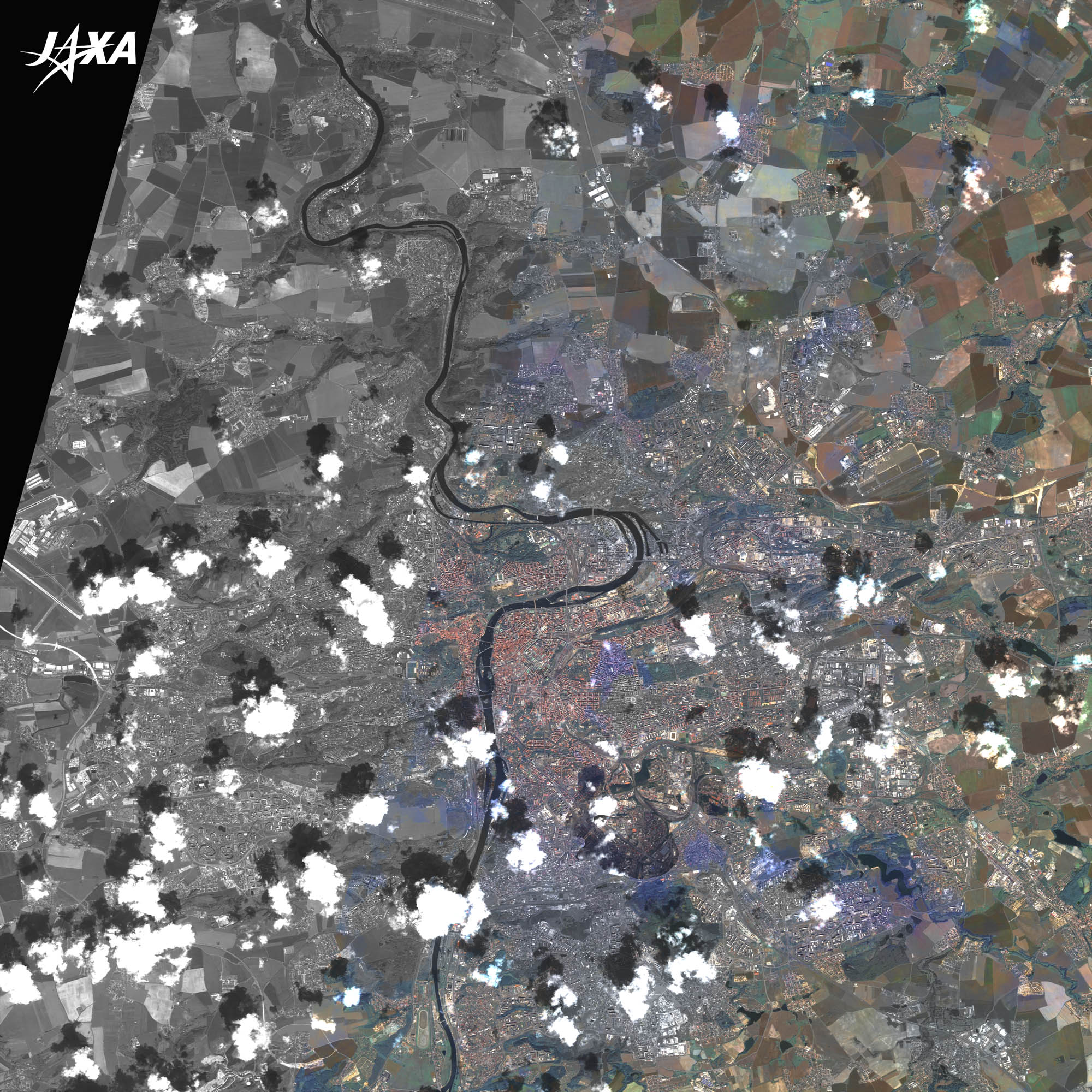 Fig. 1. Prague, Czech Republic, and Its Surroundings
Figure 1 shows Prague, the capital of the Czech Republic, and its surroundings as observed by “Daichi” – ALOS (Advanced Land-Observing Satellite) in June 2007 and in May 2008. The Vltava River runs from the bottom (south) to the top (north) of the image and eventually joins the Elbe River. The Vltava River (the “Moldau” River in Germany) is a theme of the symphonic poem “My Fatherland” composed by Czech composer Smetana (1824-1884). Prague is situated on the lower part of the large meandering Vltava River. As seen from the mosaic pattern at the upper-right, this area near Prague is a grain-producing region. You also see a part of the Prague Ruzyně International Airport at the left side of the image. 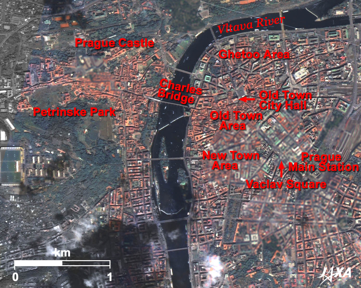 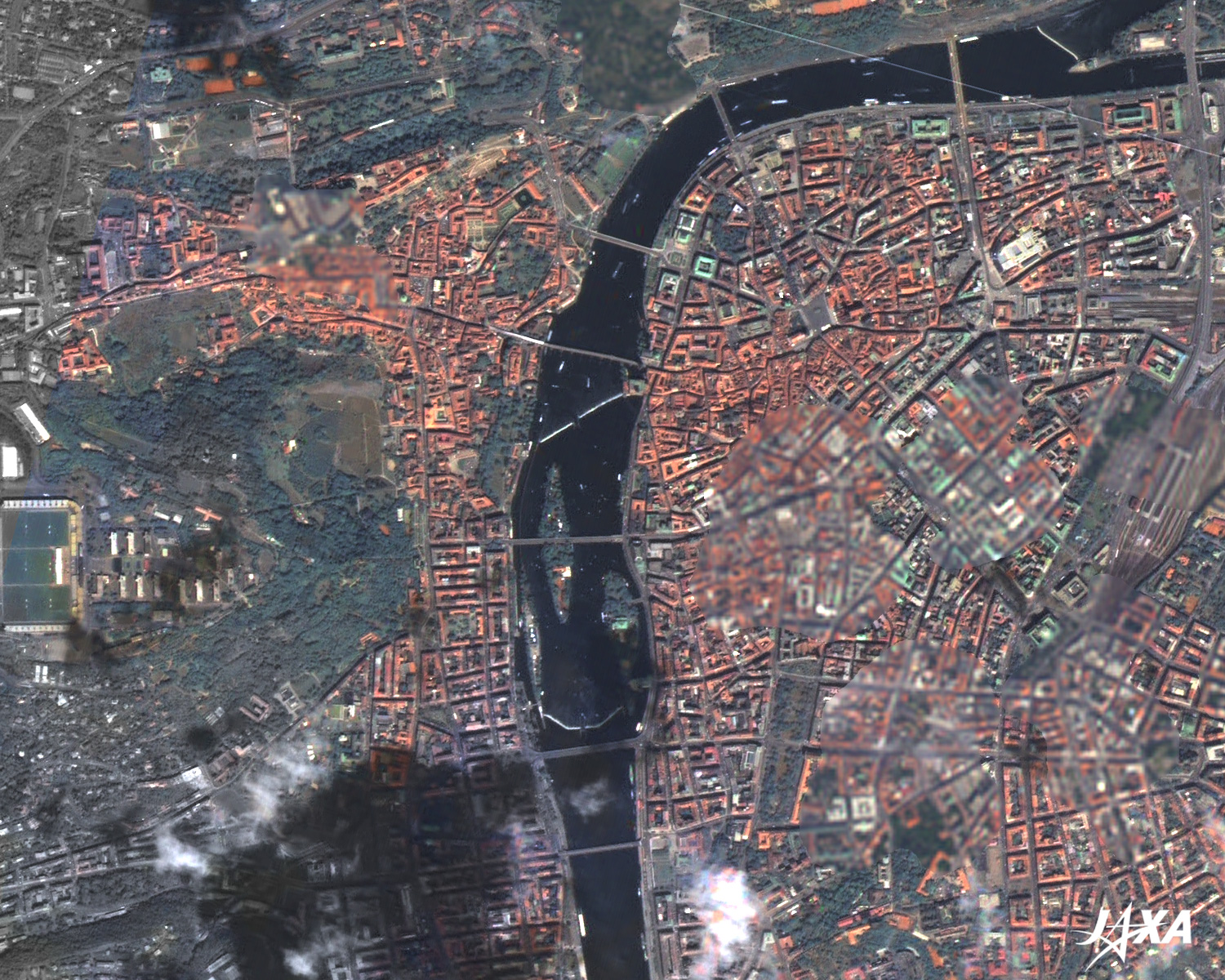 Fig. 2. Central Prague
Central Prague(kmz, 3.36 MB, Low Resolution) as seen on Google Earth. Figure 2 is an enlarged image of central Prague. Famous Charles Bridge is visible at the center of the image. Prague has been developed on both banks of the Vltava River. The areas developed on the east bank are the Old Town area, where the streets constructed in the Middle Ages remain, the New Town area with the most popular downtown in Prague, and the Jewish quarter, which was a ghetto area where the Jewish people were allowed to live. The Old Town City Hall at the center of the Old Town is famous for its astronomical clock. Vaclav Square, located in the New Town, is the place where important modern historical events in the Czech Republic took place, such as the Prague Spring in 1968 and the Velvet Revolution in 1989. At the right side of the image, Prague’s Main Station is visible. On the hilly west bank of the River, at the upper-left of the image, you see Prague Castle, a symbol of Prague. The deep green area at the left side of the image is a popular recreational spot called Petřín Park. Since Prague was not badly damaged during World War II, many old style buildings, ranging from Gothic to Renaissance, survived. Prague was registered as a World Cultural Heritage Site of UNESCO in 1992 and it is one of the most popular tourist destinations in Europe. 
Charles BridgeCharles Bridge is the oldest existing bridge in Prague. It is a nearly 520-meter-long and 10-meter-wide stone bridge and is famous for the 30 saint statues adorning its railing. It was originally a wood bridge over the Vltava River at the beginning of the twelfth century, but it was washed away by a flood in the middle of the twelfth century. The next bridge was built with stone and became an important traffic route, but it was again washed away by a flood in 1342. Construction of the present bridge started in 1357 and was completed about 60 years later. It is still used today, and has withstood many floods for over 600 years. The bridge was decorated by saint statues between the seventeenth and nineteenth century. One of the statues is Saint Francis Xavier, who is well known in Japan.
Prague CastlePrague Castle is now the Presidential Office of the Czech Republic. It is 570 meters long and its average width is 130 meters. Prague Castle is one of the oldest and biggest castles in the world according to Guinness Book of Records. Construction started in the ninth century and continued in the fourteenth century during the reign of Charles IV. The castle houses many buildings, including the Old Royal Palace, Saint Vitus Cathedral, and a monastery. Some areas are now used as museums. The present Saint Vitus Cathedral, with its pair of high towers, was constructed in 1420, but some parts were added later and it was finally completed in the twentieth century. Charles IV and other kings rest below the cathedral in the royal crypt. Explanation of the Images: (Click the images twice to enlarge.)
AVNIR-2 has four observation bands. The color composite images are usually produced by assigning red to Band 3 (610 to 690 nm), green to Band 2 (520 to 600 nm), and blue to Band 1 (420 to 500 nm). The resulting images have natural coloring as if seen by the naked eye. Each color indicates the following ground objects:
(Figure 2) |


