Seen from Space 2008
Myanmar flood water observation by PALSAR
| |
 |
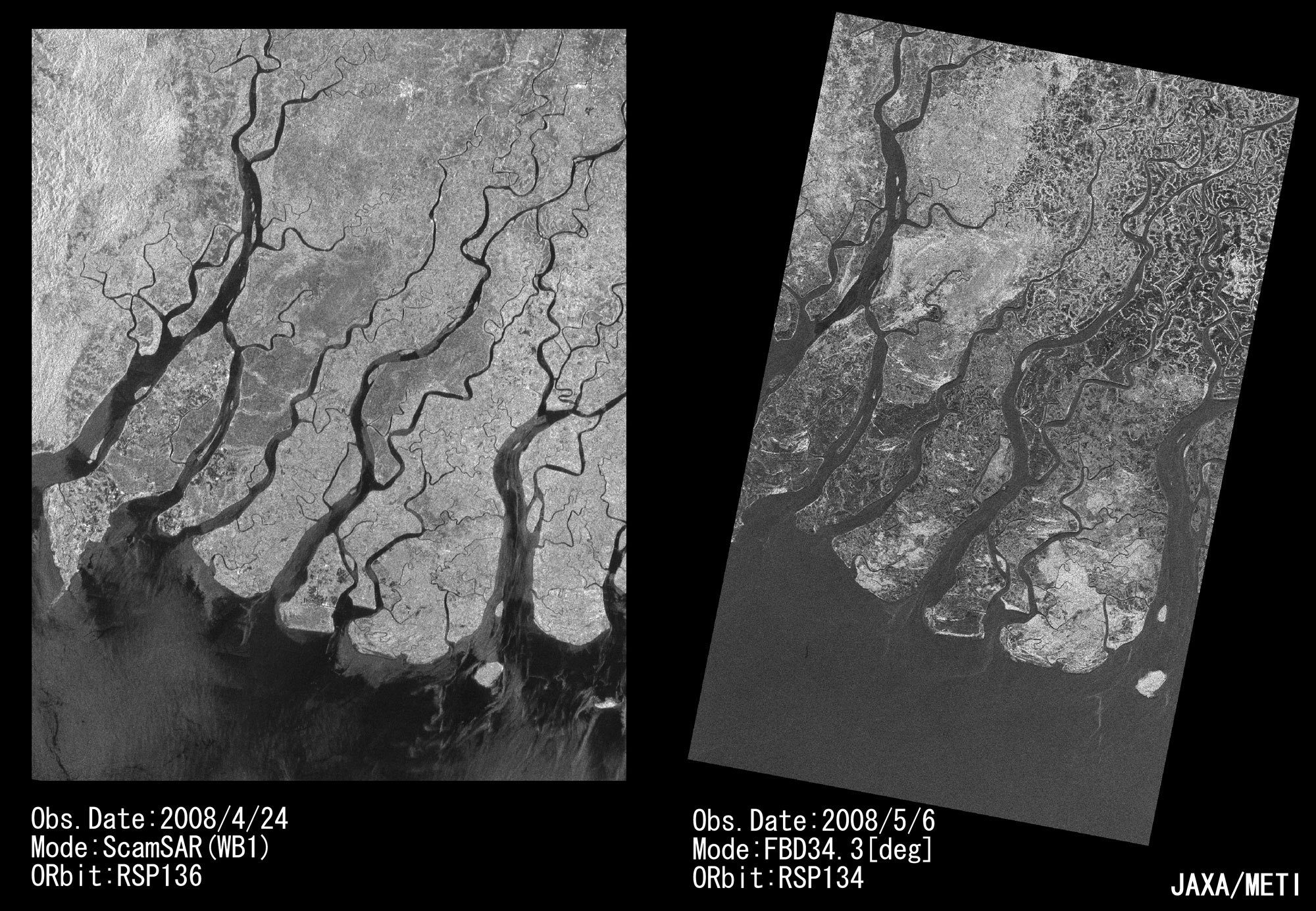
| Fig. 1. Images of Ayeyarwaddy, Myanmar, observed by PALSAR on April 24 (left), and May 6, 2008 (right) |
The left image of figure1 shows a pre-disaster image observed with ScanSAR mode on Apr. 24, 2008 and the right image depicts a post-disaster image observed with fine mode on May 6, 2008. PALSAR measures the brightness of the land and ocean surface. The flat surface, like water, tends to look dark.
Thus it is inferred from the May 6 image that large area were flooded (looks dark) by the cyclone.
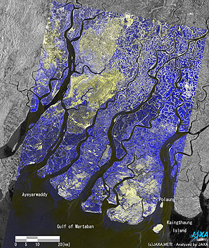 |
| Fig. 2. A color composite of the pre- and post-disaster image. |
A color composite of these images (Fig. 2), RED and GREEN for after the flood of May 6 and BLUE for the before of Apr. 24, shows the land surface change in the color. BLUE color in the figure shows the flooding in dominant and it spread out widely in the image. YELLOW color also shows increased in soil moisture due to rainfall.
 |
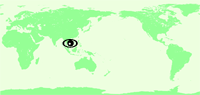
| Fig. 3. Map of observed place |
Yellow and green rectangles in figure 3 show the location of figure 2.
JAXA provided the observed data to International Charter "Space and Major Disasters" and Sentinel Asia.
Explanation of the Images:
Figs. 1 and 2. (Click the images twice to enlarge.)
| Satellite: |
Advanced Land-Observing Satellite (ALOS) (Daichi) |
| Sensor: |
Phased-Array L-band Synthetic-Aperture Radar (PALSAR) |
| Date: |
0402 (UTC) on April 24, 2008
0358 (UTC) on May 6, 2008 |
| Frequency: |
1,270 MHz (L band) |
Ground resolution
(ScanSAR mode): |
50 m |
| Map Projection: |
Equilateral |
|
The PALSAR is an upgraded Synthetic-Aperture Radar (SAR) with improved functions and performance on board the Japan Earth-Resources Satellite-1 (JERS-1). It is an active microwave sensor that can carry out observations day or night regardless of weather conditions. PALSAR is able to change its observation direction and observation mode to cover a wider range (Scan SAR.) This radar was developed in cooperation with the Japan Resources-Observation System Organization (JAROS) of the Ministry of Economy, Trade and Industry (METI.)
|
|
|