Seen from Space 2008
Ryukyu Kingdom Governed by Courtesy - Okinawa Main Island
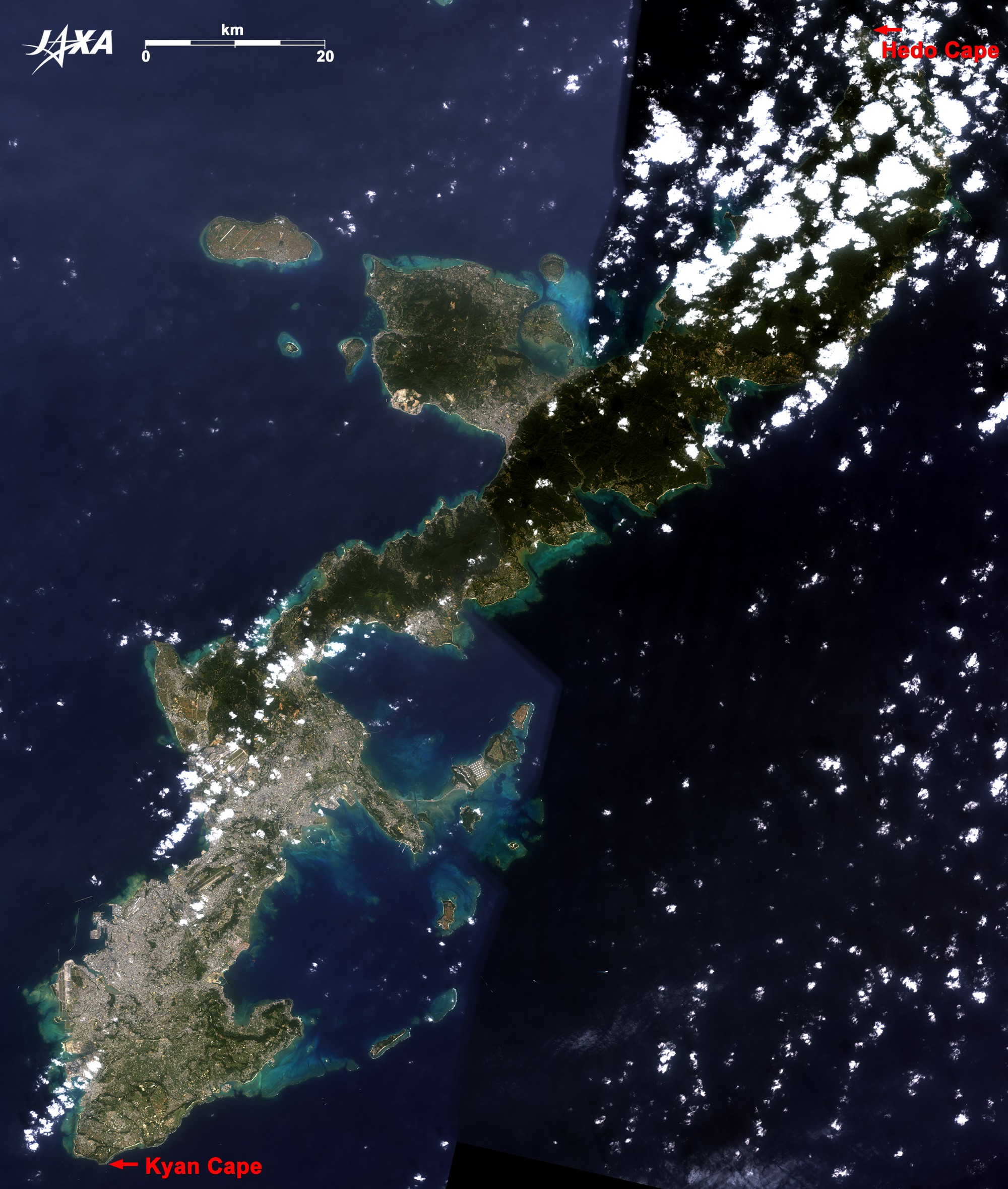
Okinawa Main Island is 135km long from Hedo Cape in the north to Kyan Cape in the south. It is 28km wide east to west at maximum and 1,207km square. Unfortunately, the north side of the image is cloudy, but the middle south side is very clear.
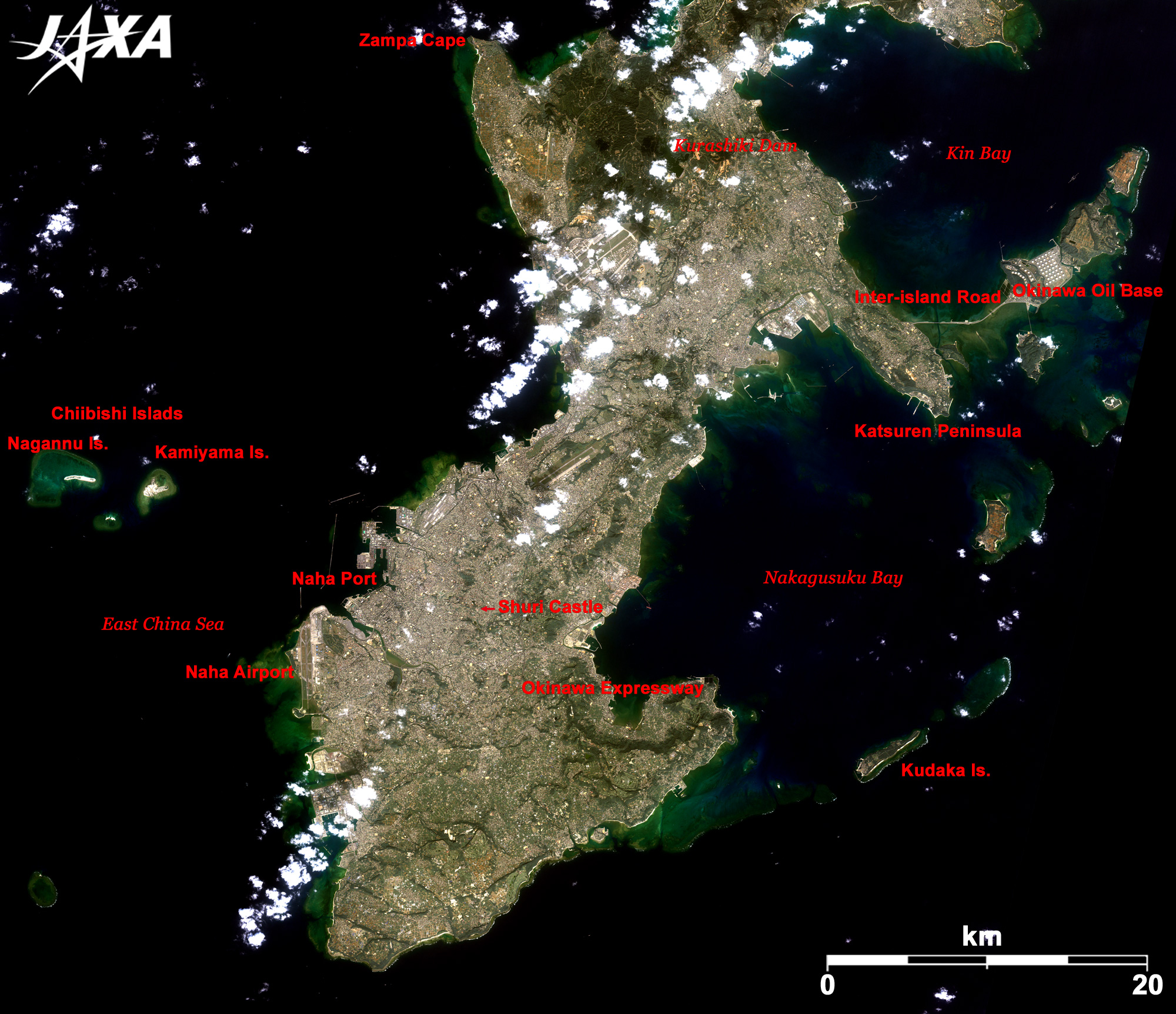
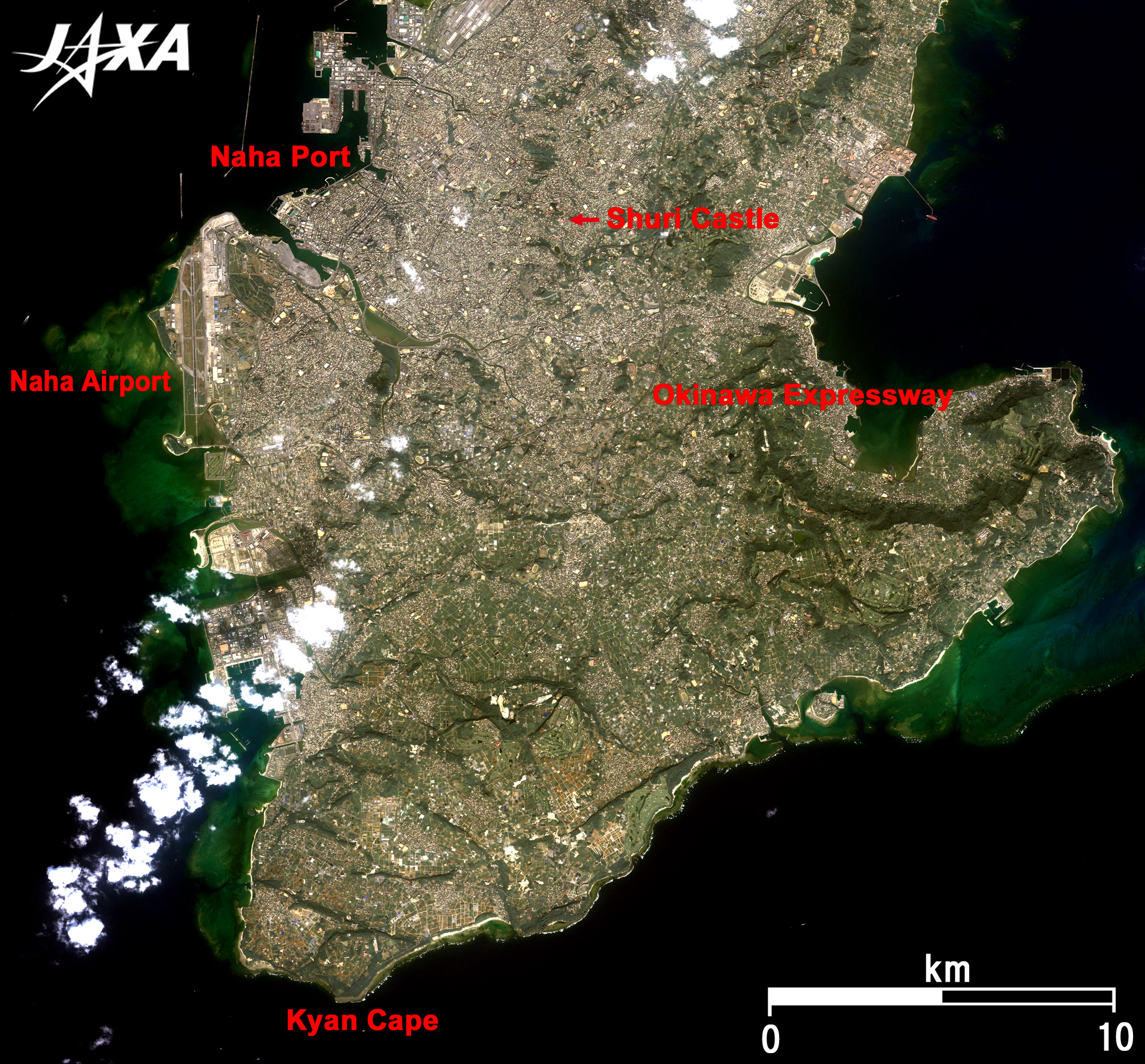
Naha Port, where international container ships for America, ferries for Amami, Kagoshima and Japan mainland, and ferries and sightseeing ships for inshore islands are anchored, and Naha International Airport are visible on the left. Yui Rail, the Okinawa City Monorail Line, was opened in 2003. It links Naha International Airport. Naha Airport Station is the westernmost station in Japan. Yui Rail runs to Shuri, an ancient city of the Ryukyu Kingdom. Shuri Castle, the center of the ancient city, is visible in the middle of the image. Shuri Castle Park was opened in 1992 as one of the Okinawa Commemorative National Government Parks. (The other park is Okinawa Churaumi Aquarium in Motobu town.) The ruins of Shuri Castle were added to the World Heritage list of the United Nations Educational, Scientific and Cultural Organization (UNESCO) in 2000, as one of the "Gusuku Sites and Related Properties of the Kingdom of Ryukyu." Note that the ruins of Shuri Castle are on the World Heritage list, but the restored castle is not. Katsuren Peninsula extending between Kin Bay and Nakagusuku Bay and the Inter-island Road linking Henza Island are visible on the right. The many white circles on the reclaimed land between Henza Island and Miyagi Island are oil tanks of the Okinawa Oil Base. The 45 large oil tanks (max storage 4.5 million kilo-liters) in the 208 million square meter area can store the equivalent of six days consumption of petroleum in Japan. Kurashiki Dam (6.9 million m3 gross storage capacity), a water tank for Okinawa Main Island, is visible on the top. The dam was constructed in 1996, upstream of where the Hijya River flows into the East China Sea. The average annual rainfall is 2,151mm in Okinawa Main Island, so it rains a lot. However, the rain falls primarily during the rainy season and typhoon season. Okinawa thus suffers damage from flood and drought. The dam provides water for people living on Okinawa Main Island.
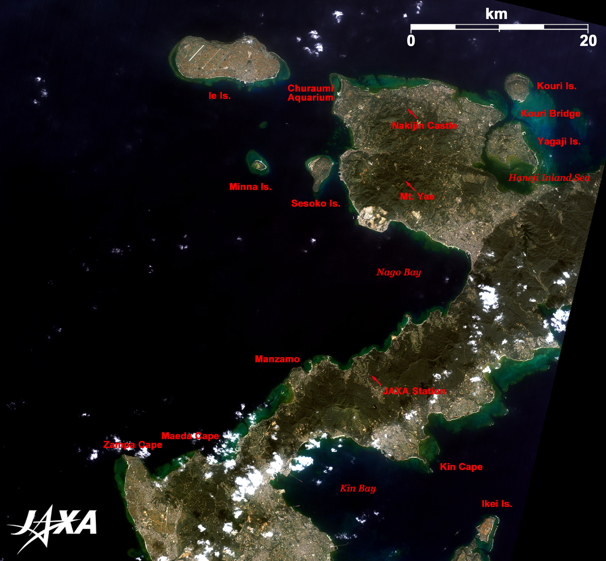
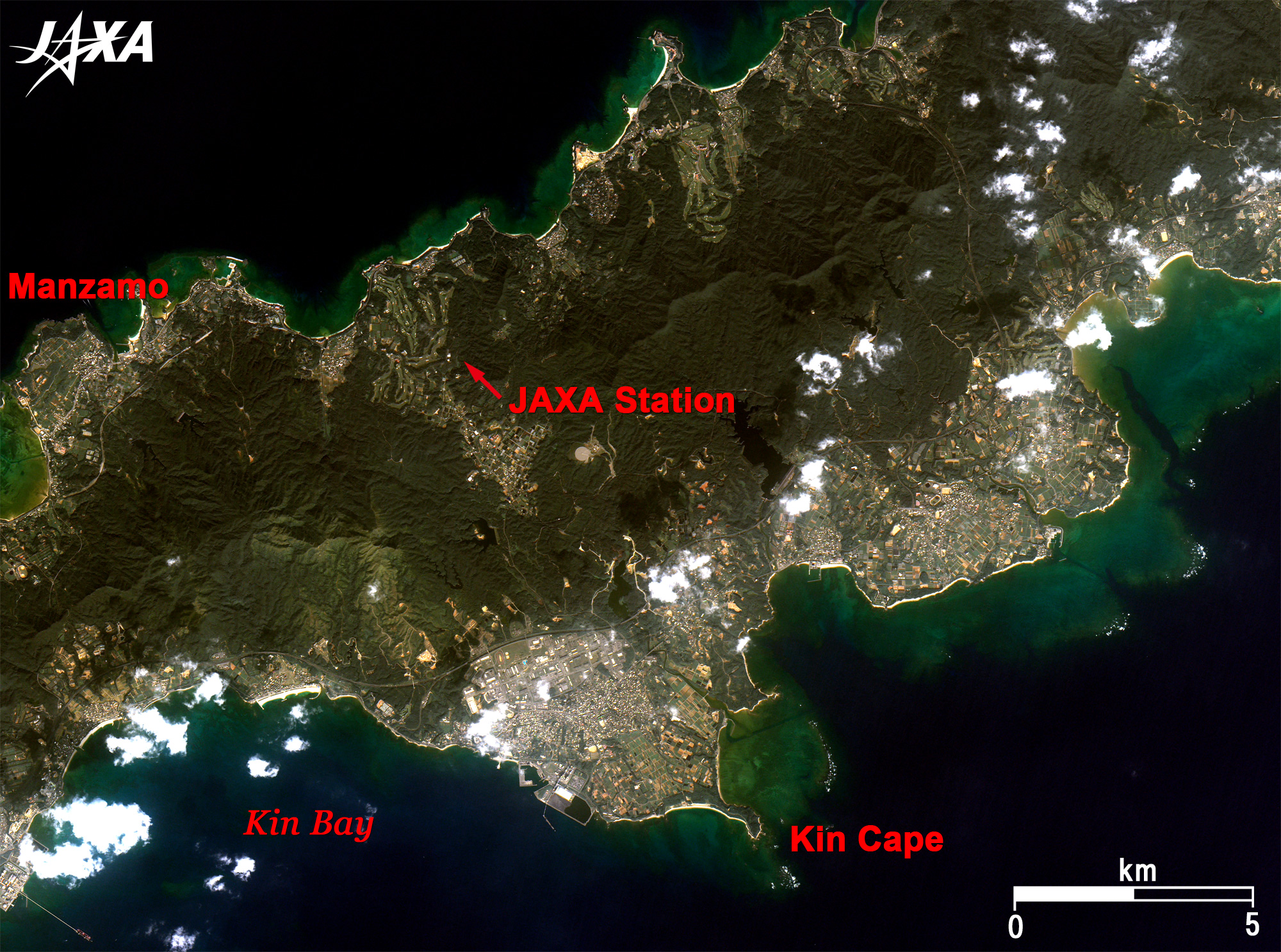
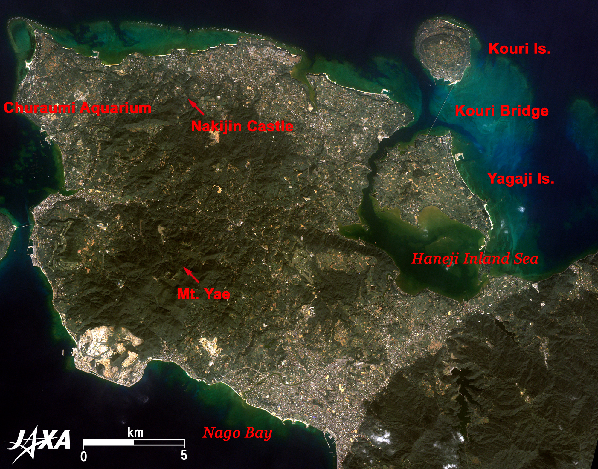
Manzamo is on the west coast. The Ryukyu King visited here and declared that it had enough space to sit ten thousand people. Wide open space as implied in its name and a rock shaped like an elephant's trunk are characteristic features. JAXA Okinawa Tracking and Communication Station with 10, 18 and 30m parabolic antennas is near Manzamo. Please feel free to visit the station; there is no admission fee. Motobu Peninsula extending to the East China Sea contains the ruins of Nakijin-Gusuku (Gusuku means Castle), the center of Hoku-zan during three Zans (Zan means mountain or area) period in 1322 to 1429 (Hoku-zan to the north, Chu-zan in the middle, and Nan-Zan to the south). The ruins of Nakijin-Gusuku were also added to the World Heritage list in 2000. The Nakijin-Gusuku and Yae-dake Mountain in Motobu town boast the earliest cherry blossoms (Pinky Ryukyu Kan-Hi-Sakura) in Japan. Kouri Island, 8km in circumference, is linked to Yagaji Island by the 1,960-m-long Kouri Bridge (opened in 2005), the longest free bridge in Japan. Haneji Inland Sea lies between Yagaji Island and Motobu Peninsula and is dotted with many islands like the famous Japanese Matsushima. Sesoko Island, Minna Island and Ie Island with their beautiful beaches are visible on the left of the peninsula. Okinawa Churaumi Aquarium, where large whale sharks swim, is at the tip of the peninsula. It is located on the site of the Okinawa Ocean Exposition that was held in 1975. Okinawa Main Island is developing as a southern resort but is being cautious to protect the natural environment of the Yambaru area.
|
||||||||||||||||||||||||||||||||||||||||