Seen from Space 2004
Smoke aerosol from Mt. Asama
An aerosol plume from the active Mt. Asama volcano was detected by the MODIS sensor on NASA's Earth observation satellite Terra. In Figure 1 the aerosol optical thickness is shown for the area around Japan , based on data acquired by MODIS on September 16, 2004 . Aerosols are tiny particles suspended in the air, which occur naturally, originating from volcanoes, dust storms, forest s , grassland fires, and sea spray. Human activities, such as the burning of fossil fuels from traffic and plants also generate s large amounts of aerosols. Optically thick (dense) aerosols (depicted in red and yellow) can be recognized around the Tokyo metropolitan area, northwest of the Izu Peni n sula , and in the southern part of the Sea of Japan . The plume northwest of the Izu Peninsula , stretching from north to south , can be recognized as the smoke and ash plume from Mt. Asama . The optically thick aerosol in the Tokyo metropolitan area is supposed to originate from the exhaust smoke of plants and traffic in this densely populated region. Since the MODIS aerosol algorithm is based on the dark target method, the optical thickness value s might be overestimated due to the bright ground surface of the urban area. The aerosol in the southern part of the Sea of Japan is considered to consist of particles originating on the Asian continent that were carried to this region. The sunglint area over the oceans east of Japan , as well as cloudy areas are screened out , because the a lgorithm can not be appli ed there.
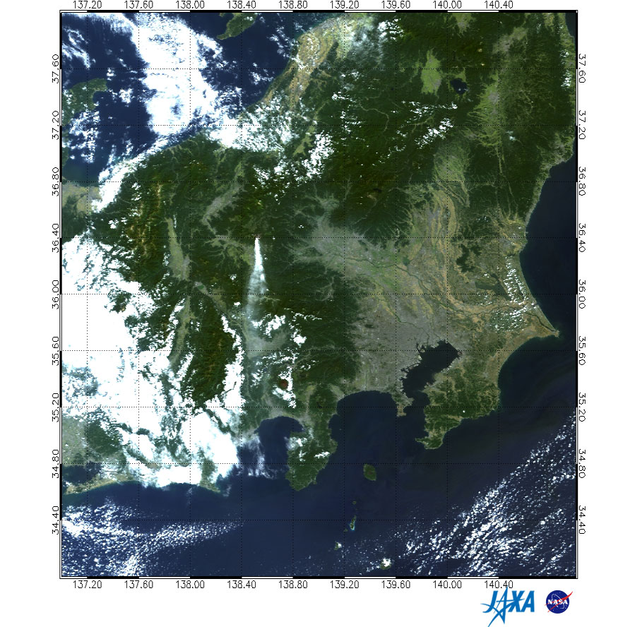
Fig. 2 shows a MODIS RGB image with natural coloring, the same as seen with the naked eye. The image was created from MODIS data acquired at the same time as the one shown in Figure 1. The thick plume of smoke and ash spurting out from Mt. Asama and transported straight to the south is clearly visible from space. The sky was mostly clear in the Kanto and Ko-Shin-Etsu areas on that day. (*)The aerosol optical thickness describes the total amount of light reduction by aerosol scattering and absorption within the atmospheric column, which depends on the total amount of aerosol present, and properties of the aerosol such as particle size, density and refractive index. It is defined as one when the incident light is attenuated by 1/e (approximately 0.368).
Related sites: |
|||||||||||||||