
What's TRMM?
TRMM means "the Tropical Rainfall Measuring Mission". Here, you can get detailed information and also view it on Google Earth.
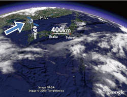
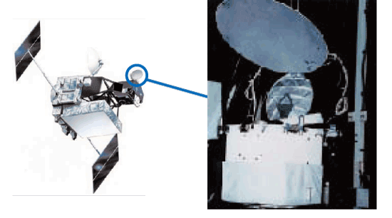
 a) How many height TRMM satellite?
-
TRMM satelite are flying 400km above us. It is the same distance of Tokyo to Osaka.
 Let's show TRMM Satellite position by Google Earth.

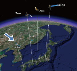
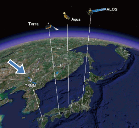
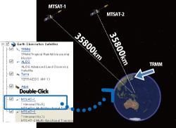
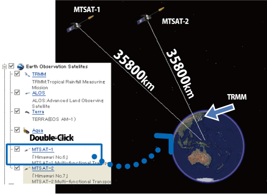
- b) Let's compare satellites height.
-
By using this KML file, you can see the TRMM and other satellite's positions.
Let's compare other sattelites by Google Earth
TRMM satellite flies lower than other earth observation satellites.
- c) How many height Himawari satellite
-
You can jump to Himawari Satellite on Google Earth.
Geostationary orbit satellite's position is higher than other satellites.
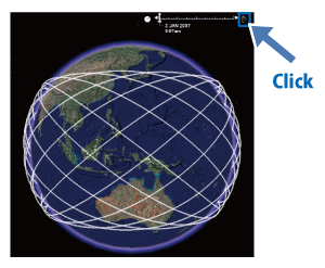
- a) Daily satellite tracks
-
This KML file shows daily satellite tracks of TRMM.
TRMM Track at 2007/1/2
Click "Play" button on Upper Right side. TRMM satellite will move on Google Earth.

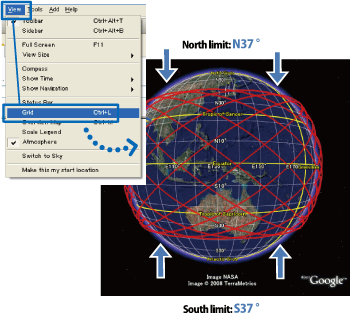
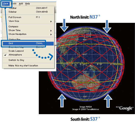
- b) North and south limit
-
TRMM satellite is moving from 37 degree south to 37 degree north, coz the main observation target of TRMM is "Tropical Rain Fall".
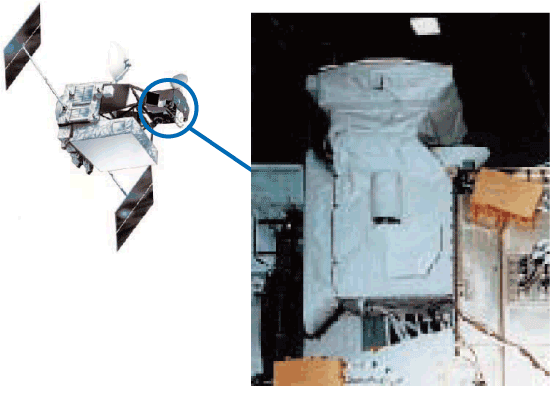
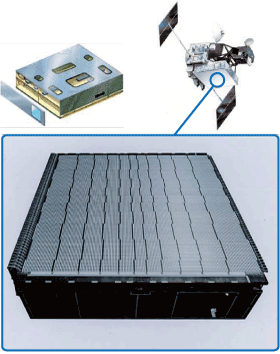
- a) PR: Precipitation Radar
-
The Precipitation Radar(PR) onboard TRMM is the first spaceborne rain in the world. Major objectives of PR are (1) to provide 3-dimensional rainfall structure, (2)to achieve quantitative rainfall measurement over land as well as over ocean, and (3) to improve the accuracy of TRMM Microwave Imager (TMI) measurement by providing the rain structure information.
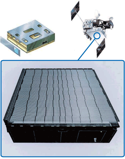
- b) TMI: TRMM Microwave Imager
-
The TMI is a multi-channel / dual-polarized microwave radiometer which will provide data related to rainfall rates over the oceans. The TMI data together with PR data will be the primary data set of precipitation measurement. The TMI data combined with the data from the PR and VIRS will also be utilized for deriving precipitation profile.
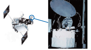
- c) VIRS: Visible Infrared Scanner
-
The VIRS is a passive cross-track scanning radiometer which measures scene radiance in five spectral bands operating in the visible through the infrared spectral regions. Comparison of the microwave, visible and infrared data is expected to provide the means whereby precipitation will be estimated more conclusively by visible and infrared data alone.