
How to use Google Earth?
Google Earth is the most famous digital earth browser which made by Google Inc. It maps the earth by the superimposition of images obtained from satellite imagery, aerial photography and GIS 3D globe. Furthermore, Google Earch can be used with satellite images of TRMM. Start our Google Earth Training with following introductions.
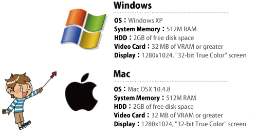
 a) Can you run Google Earth on your PC?
-
- b) Download
-
Install the latest version of Google Earth.

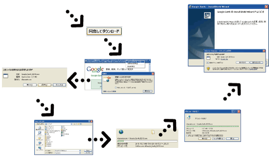
- c) Install
-
Using the downloaded file, you can install/update to the latest version of Google Earth.

- a) Startup
-
Enter the world of digital earth, by double-clicking the Google Earth icon.
Also, you can start Google Earth with double-clicking a KML file icon.

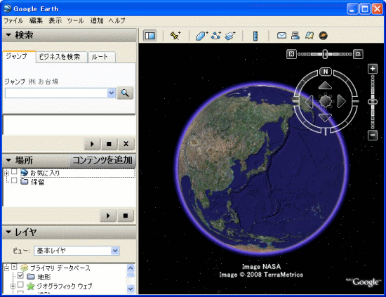
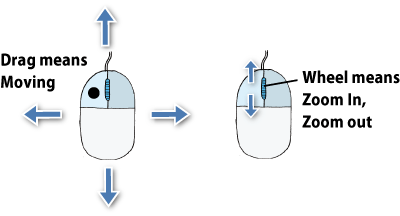
- b) Basic operation
-
It's not difficult to operate Google Earch.
Dragging for moving to other places. Wheel actions for zoomin/out.
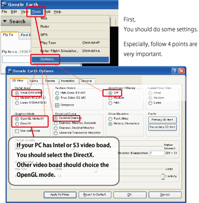
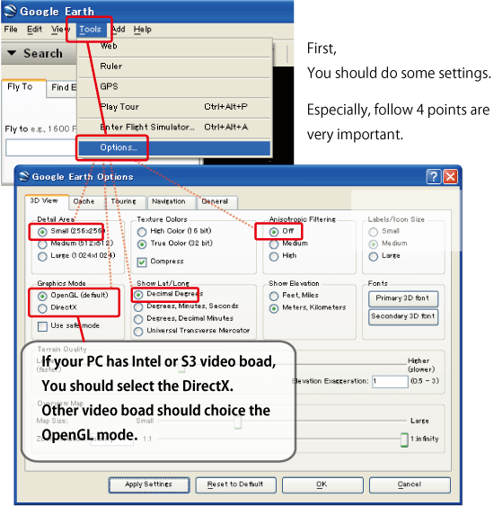
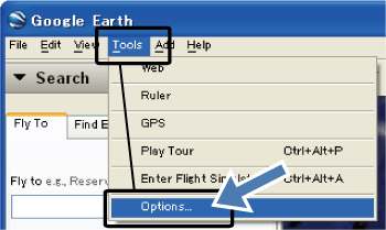
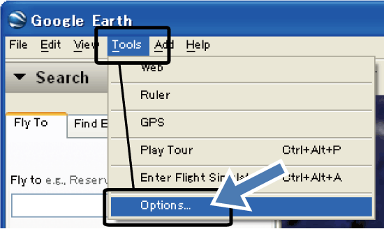
- c) First setting
-
Optimize the Google Earth settings for more comfortable operations.
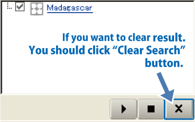
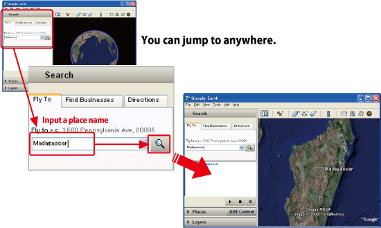
- a) Jump
-
Jump into any places you want, by searching the name of a place.

Clear the searched results by clicking the right button.
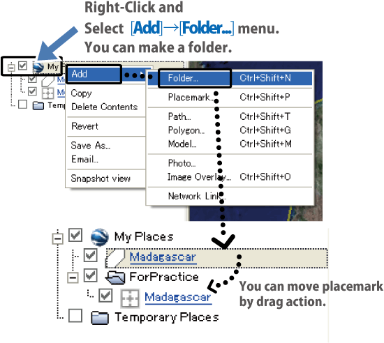
Move the searched place marks into My Places panel by dragging.
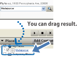
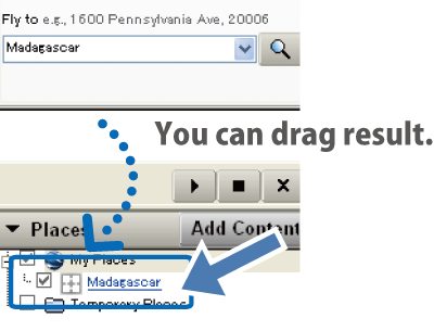
- b) My Places
-
My Places panel is "book mark of places", where the placemarks are saved.
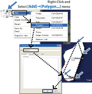
Here, we are going to make a coast line data of Madagascar Island for example.
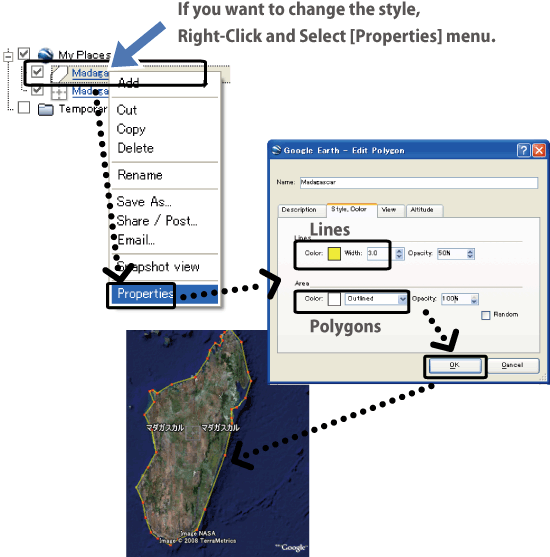
Modify the colors of the placemarks from Properties.

Add a folder in My Places Panel from right-click menu.

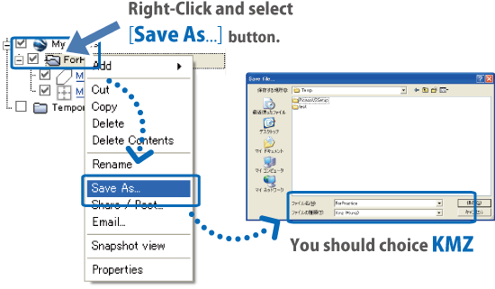
Save the data on My Places panel in KML/KMZ format from right-click menu.
KMZ is recommended as a saved format, because of the usefulness in later operations.


- c) Layers
-
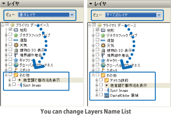
Layers panel is like a "mapping information library".
You can show roads, shopping and services from this panel.
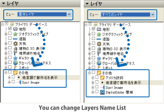
The panel is set as "core layers" mode in default.
To show all layers, change the setting to "all layers" mode.
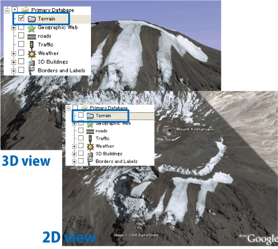
"Terrain" is one of the most important layers.
Fly over the world in bird-view by using this layer.

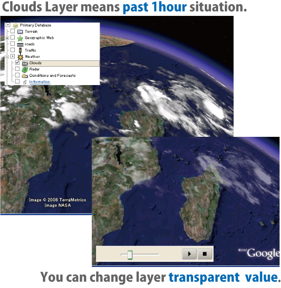
"Weather" is another important layer.
This layer shows the corrent cloud covers of the world.

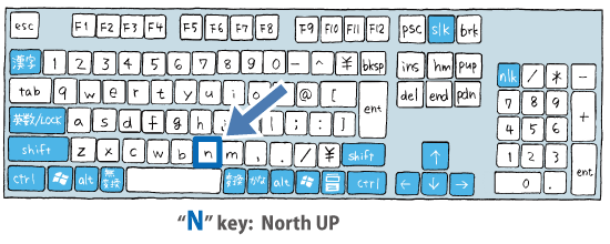
- a) Up to North
-
Show norh direction on top by clicking "N".

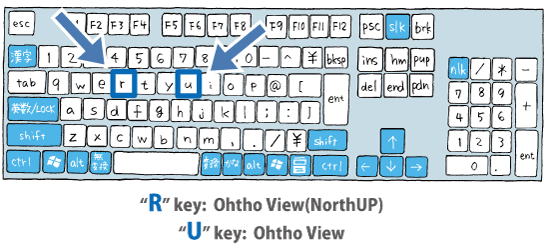
- b) Ortho View
-
Change to ortho view by clicking "R" or "U".

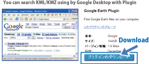
- c) Search KMLs on your PC
-
Search your KMLs on your PC by using Google Desktop Plugin
Download the plugin from here.

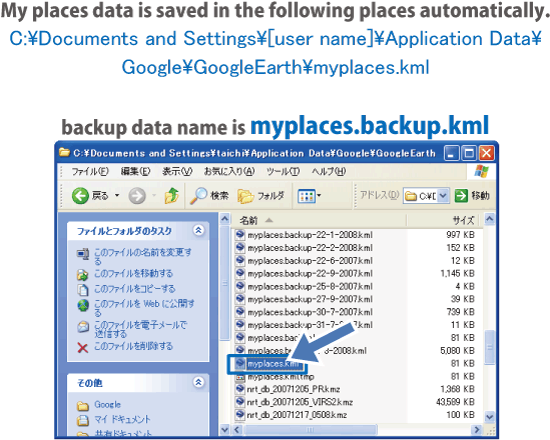
- d) KML Recovery
-
Google Earth saves My Places information in
C:\Documents and Settings\User Name\Application Data\Google\GoogleEarth\myplaces.kml automatically
To recover the post My Places files, open a "myplaces.backup.kml" file.

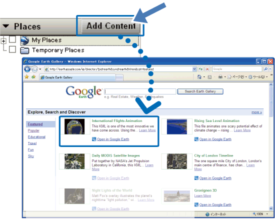
- e) Get KML made by other users
-
Add another user's KML contents from "Add Content" button.
This button opens this webpage.

- a) When Google Earth goes slow...
-
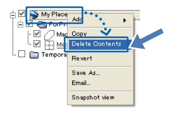
If your Google Earth moves too slow,
clear the files in My Places panel from [Delete Contents] in right-click menu.

Change the graphic boad setting.
If your PC has graphic board made by Intel/S3, it is recommended to set the graphic board to DirectX.
([Start] > [Program] > [Google Earth] > [Startup as DirectX mode] )
Change the window size to smaller one.

- b) If you can't start Google Earth
-
test the net connection whether works properly.
Sometimes you can use Google Earth by installing an older version, if you can find it.
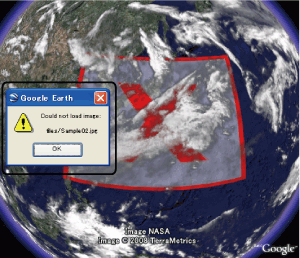
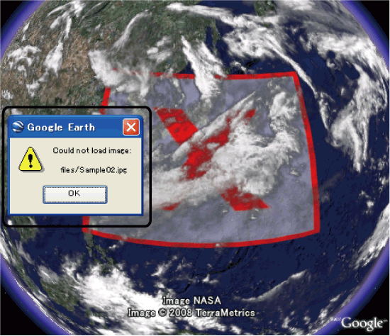
- c) Can't open my KML!
-
If your KML file includes external links such as "networklink" or "image overlay", check those links surely work or not.