Mt. Bezymianny in the eastern part of the Kamchatka Peninsula erupted on December 20, 2017.
According to the image analysis result of the meteorological satellite Himawari-8, it was reported that the volcanic smoke had reached an altitude of 15,000 meters and spread to the northeastward. Fig. 1 are images of Kamchatka Peninsula from 20th to 24th December 2017 observed by GOSAT/TANSO-CAI. Fig. 2 are enlarged images of the area around Mt. Bezymianny. These images show that the volcanic ash generated from Mt. Bezymianny spread to the northeastward. They also show the eruption of Mt. Shiveluch located at the north of Mt. Bezymianny with the eastward volcanic ash. It seems that the volcanic ashes generated from Mt. Bezymianny and Mt. Shiveluch were crossing.
The Kamchatka Volcanic Eruption Response Team (KVERT) has issued the airplane navigation was influenced by the present Mt. Bezymianny eruption as the aviation color code of yellow, which is the second of the four alert levels behind the highest color of red. The eruption of Mt. Bezymianny becomes calm, but continuous vigilance is necessary.
※The TANSO-CAI image was composed of band2 (674nm) in red, band3 (870nm) in green and band1 (380nm) in blue.
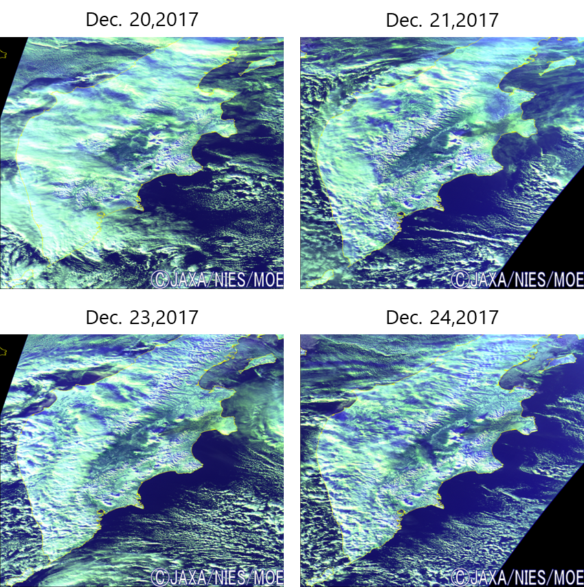
Fig. 1. The GOSAT/TANSO-CAI images of eruption of Mt. Bezymianny and Mt. Shiveluch.
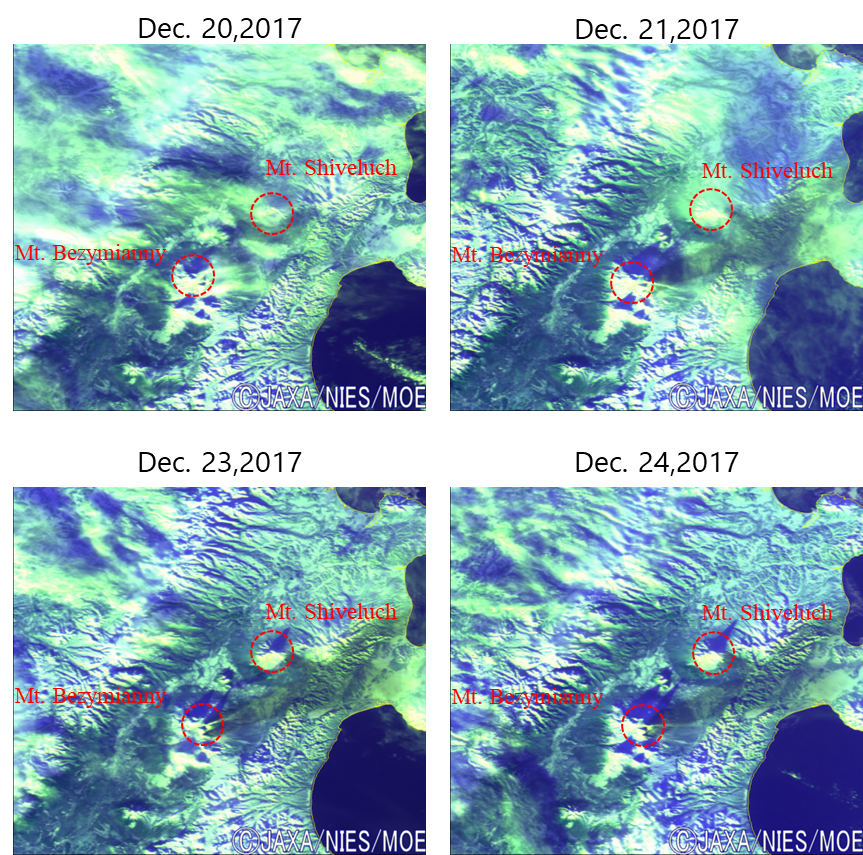
Fig. 2. The GOSAT/TANSO-CAI images enlarged around Mt. Bezymianny.
Related article:KVERT Kamchatka Volcanic Eruption Response Team
