On June 11, 2009 (UTC), Sarychev Peak, which is located on Matua Island in the Kuril Islands, began to erupt. Since volcanic fumes reached higher than 10 km above sea level, airline companies had to change their flight schedules and routes. The Japan Aerospace Exploration Agency (JAXA) performed an emergency observation on June 19, 2009 using the Phased Array Type L-band Synthetic Aperture Radar (PALSAR) installed on the Advanced Land Observing Satellite (ALOS) to detect surface change of the volcano caused by the eruption.
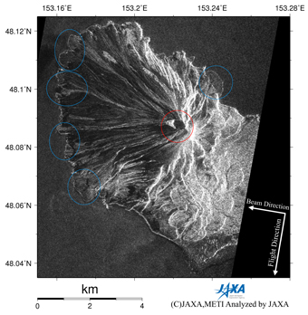
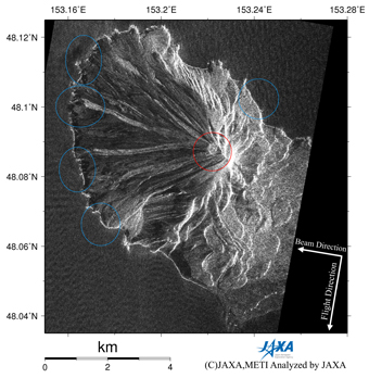
Fig.1: PALSAR amplitude images acquired before (right: 2007/3/14) and
after (left: 2009/6/19) the eruption.
(Click to View Enlarged Image)
Figure 1 left is a PALSAR amplitude image acquired after the eruption with the same observation mode (on descending orbit with an off nadir angle of 34.3°) as that acquired before the eruption (right). As is shown in these results, PALSAR can observe the target area without being interrupted by clouds or volcanic fumes. Comparing these images, we find an obvious change of appearance around the crater (red circle). Moreover, we find obvious changes along the coast probably due to pyroclastic flows or lahar, which effused from the crater almost radially (blue circles).
JAXA plans to continue ALOS observations of the Sarychev Peak.
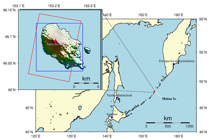
Fig.2: Overall view of the observation area.
(Click to View Enlarged Image)
©JAXA EORC
Copyright©1997- JAXA EORC All rights reserved.