On April 13, 2010 (UTC), a magnitude 6.9 earthquake occurred in southern Qinghai, China, where is located about 1900km southwest of Beijing. The Japan Aerospace Exploration Agency (JAXA) performed an emergency observation on April 17 using the Phased Array Type L-band Synthetic Aperture Radar (PALSAR) installed on the Advanced Land Observing Satellite (ALOS) to determine the state of damage caused by the earthquake. In this report, we compared PALSAR amplitude images taken before and after the earthquake to detect collapsed buildings in inhabited areas including Yushu and conducted differential interferometric SAR (DInSAR) analysis to detect crustal deformation associated with the earthquake using the data acquired on January 15, 2010.
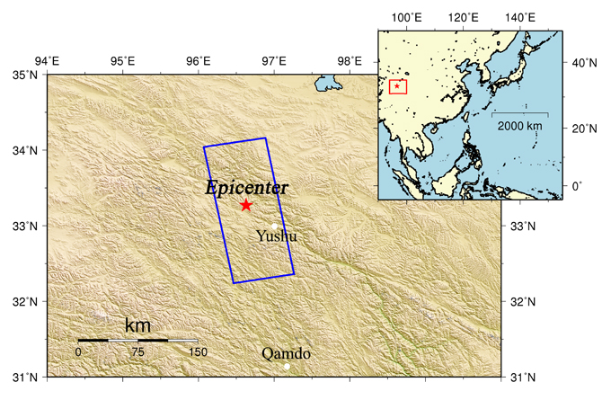
Fig.1: An overall view of the observation area (We refer to SRTM3 as terrain data.)
(Click to View Enlarged Image)
The blue rectangle indicates observation areas shown in Figure 2, and the red star represents the epicenter.
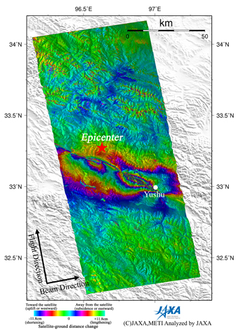
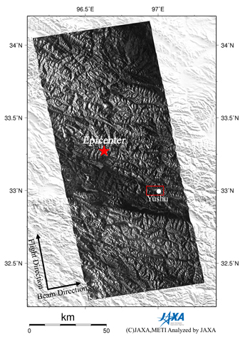
Fig.2: PALSAR interferogram showing deformation map (left) and PALSAR amplitude image (right)
(Click to View Enlarged Image)
Figure 2 left is an interferogram generated from PALSAR data acquired before and after the earthquake using the DInSAR technique. A color pattern illustrates changes of satellite-ground distance for the period (2010/1/15-2010/4/17). Figure 2 right is a PALSAR amplitude image acquired after the earthquake indicating an observation field of 200 km from south to north. In the interferogram, there is discontinuity line of color pattern in a northwest-southeast direction and there are several color fringes in north and south of the line. The color fringes indicate crustal deformation associated with a seismic faulting and the discontinuity line indicates a boundary of the deformation pattern. Also in Figure 2, we can see that Yushu, where heavy damages have been reported, is located near the line and located in deformation area. In this report, ALOS revealed rough strike direction of the seismic fault, crustal deformation, and the boundary line of the deformation.
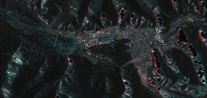
Fig.3: A PALSAR amplitude image (Red : Jan. 15, 2010, Green and Blue : Apr. 17, 2010).
(Click to View Enlarged Image)
Figure 3 shows a PALSAR amplitude image around Yushu which is surrounded by a red rectangle in Figure 2 right panel. Red colors are assgined to an amplitude image on Jan. 15, 2010, while green and blue colors are given to an image on Apr. 17, 2010. Some blank at slopes in mountains are corresponding to layover area, strong red and green-blue colors around these blank area are also caused by foreshortenings. In comparison to left side (west area) of Figure 3, these are some red color area in central and right sides (mid and east area) of Figure 3, which means that sigma-naught after the earthquake is smaller than that before the earthquake in these area. This result also indicated that some constructions could be broken after the earthqeake in these area.
JAXA plans to continue ALOS observations of the afflicted area in Qinghai, China.
* The color changes from red, blue, green, yellow and back to red indicate an shortening of the satellite-ground distance, and one color cycle = 11.8cm.
©JAXA EORC
Copyright©1997- JAXA EORC All rights reserved.