


Observed images, research and application examples by ALOS.
Update
Dec. 22, 2008
PALSAR
PALSAR
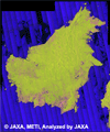
The Borneo, New Guinea, Solomon, Sulawesi and Sumatra of PALSAR 50m Orthorectified Mosaic Product were added.
Dec. 11, 2008
PALSAR
PALSAR
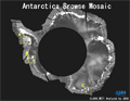
K&C Browse Mosic Products of Cycle 21.
Nov. 28, 2008
PALSAR
PALSAR
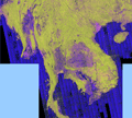
The Indochina of PALSAR 50m Orthorectified Mosaic Product were added.
Oct. 3, 2008
PALSAR
PALSAR
K&C Mosic Products of Cycle 17.
Sep. 17, 2008
PALSAR
PALSAR
K&C Mosic Products of Cycle 20.
Aug. 18, 2008
PALSAR
PALSAR
IPY Dataset Homepage was opened.
Jul. 24, 2008
PALSAR
PALSAR
K&C Mosic Products of Cycle 18.
Jun. 17, 2008
PALSAR
PALSAR
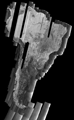
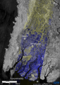
Myanmar
Flood
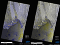
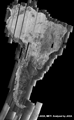
Myanmar flood water observation by PALSAR (II).
May 9, 2008
PALSAR
PALSAR
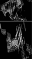
Myanmar
Flood
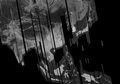
Myanmar flood water observation by PALSAR.