1) Digital Elevation Model (DEM) and Mapping | 2) Land Use Monitoring and Land Cover Classification | 3) Disaster Monitoring | 4) Geological Surveying and Mineral Resource Exploration | 5) Terrestrial Ecosystem and Forestry Management | 6) Oceanography and Coastal Zone Related Research | 7) Snow and Ice Related Research | 8) Agriculture Management | 9) Hydrology and Water Resource Management | 10) Application Research using Geographical Information | 11) PRISM / AVNIR-2 | 12) PALSAR | 13) Thailand (JAXA-GISTDA collaboration)
3) Disaster Monitoring 2016
Update
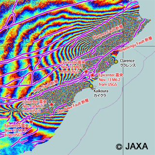
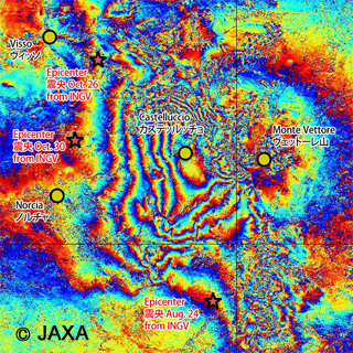
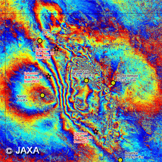
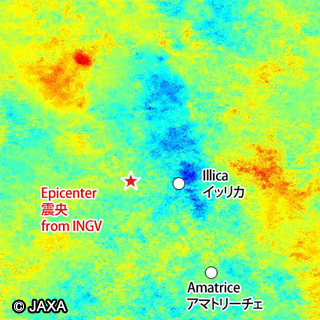
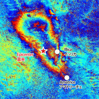
ALOS-2/PALSAR-2 Observation Results on M 6.2 earthquake in central Italy. [Update on Nov. 11, 2016]
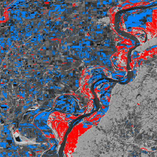
![[Update on Jan. 21] Estimated inundation map of Flooding on the Mississippi River](../../../../ALOS-2/en/new/20160116_mississippi/top_mississippi-flood_20160116.jpg)
![[Update] Estimated inundation map of Flooding on the Mississippi River](../../../../ALOS-2/en/new/20160111_mississippi/top_mississippi-flood_20160111.jpg)