NASDA's EORC classifies ALOS data application research areas into the following 12 categories, and seeks to promote researches that have potentialities of ALOS data utilization.
- Evaluation of sensor characteristics and image quality of acquired data for PRISM and AVNIR-2
- Geometric calibration and validation and radiometric calibration and validation for acquired image data
- Development of fast and accurate extraction method of geo-physical parameters
- Evaluation of sensor characteristics and image quality of acquired data for PALSAR
- Geometric calibration and validation and radiometric calibration and validation for acquired image data
- Improvement of analysis method utilizing microwave scatter and SAR interference
- Development of method for automatically producing DEMs
- Development of method for automatically producing orthophoto image (mapping image)
- Technical development aimed at efficient renewal of mapping
- Algorithms development for automated and high accuracy land cover classification
- Monitoring vegetation and land use change due to urban development, housing, etc.
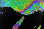
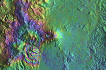
- Earthquakes, land surface deformations, and volcanic activity
- Forest fire, and flood
- Landslide, slope failure, and land subsidence
- Ocean contamination due to oil tanker accident
Damage monitoring in case of the above-mentioned disasters, and prediction of damage size and danger spots.
- Geological Surveying and Mineral Resource Exploration
- Geological surveying and mineral resource exploration by not only PALSAR data but also multiple utilization of DEMs, orthophoto images, and other satellite data
- Clarification of carbon cycle mechanism and vegetation dynamics which play a vital role in global warming (such as Global Forest Mapping project using JERS-1 data)
- Monitoring forest and pastures change due to human activities such as urban development, deforestation aimed at firewood and/or exporting, and slash-and-burn agriculture, and natural disasters like forest fire and drought
- Estimating and monitoring productivity and growth of crop land, pastures and forest, forest distribution, crop planting conditions, and damage by blight and insects
- Researches on wave, sea surface wind, water current and sea ice
- Grasping ocean dynamics
- Monitoring land surface deformation due to soil erosion and sedimentation in coastal areas
- Monitoring distribution and growth of coral reef
- Monitoring ocean contamination due to oil tanker accident and influx of polluted river water, and investigating red tide influence to fisheries in coastal areas
- Monitoring widespread snow cover and snow water equivalence analyzing data from PALSAR and AVNIR-2
- Monitoring distribution and temporal variation of glaciers, drift ice and sea ice
- Understanding variatoin of mass balance of ice sheets and glaciers in polar areas such as the Antarctic and Greenland
- Researches on productivity and growth of crop land and pastures, planting condition, and change estimation
- Development of algorithms measuring soil moisture distribution
- Analysis of land surface deformation, flow-route changes and land activities in river basin due to soil erosion and sedimentation
- Analysis of runoff variation using information on land use, land cover change and DEMs, etc
- Analysis of water contamination
- Overall water resources management in areas for which data was lacking

- Maintenance of Geographical Information System (GIS) that integrates mapping data, statistical information, etc.
- Researches on land management, e.g. planning and maintenance of urban facilities such as housing, railroads, roads, sewerage and water service, and support for their administration
- Researches relevant to residential areas, such as environmental assessment, and monitoring temperature change like heat-island phenomena
- Preservation of important remains
- Damage projection and prevention strategy of epidemic diseases and worms, using vegetation map, data on soil moisture distributions, etc.