7. Terrestrial Ecosystem and Forestry Management
JERS-1 SAR Mosaic Image of South America
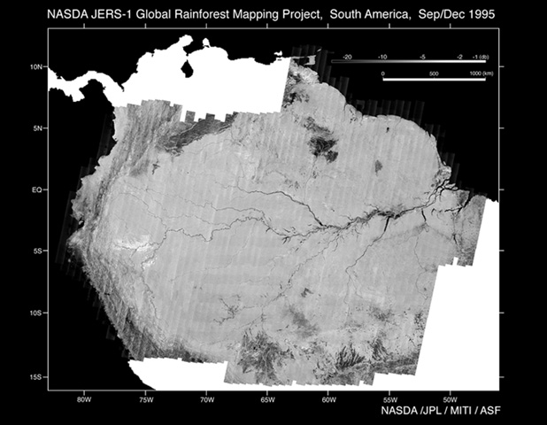
Fig. 1: JERS-1 SAR mosaic image of South America. (Click to View Enlarged Image)
 This mosaic of the Amazon Rain Forest consists of over 1,500 high resolution JERS-1 L-band SAR images. The data were acquired between September and November of 1995, during the low flood season of the Amazon River, and downlinked to receiving stations in Japan and Alaska. The images were then processed and mosaiced by the NASDA Earth Observation Research Center, and NASA's Alaska SAR Facility (ASF) and Jet Propulsion Laboratory (JPL) in the USA. The area covered lies along the equator between Latitudes 10 degrees north and 15 degrees south and between Longitudes 45 degrees West and 85 degrees West.
This mosaic constitutes the first high-resolution, cloud-free image of the Amazon Rain Forest taken during a single season. Since the L-band SAR is very sensitive to flooding conditions, this mosaic, in conjunction with another complete mosaic obtained during the high flood of the Amazon River (May-July 1996), will be used to estimate the extent of flooding that occurs every year along the Amazon river.
Extract from the JERS-1 Earth View published by NASDA EORC
©JAXA EORC /METI /JPL /ASF