Data Application Researches
7. Terrestrial Ecosystem and Forestry Management
JERS-1 SAR Mosaic Image of Africa
7. Terrestrial Ecosystem and Forestry Management
JERS-1 SAR Mosaic Image of Africa
JERS-1 SAR Mosaic of Equatorial Africa
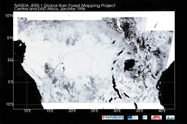
Fig. 1: JERS-1 SAR mosaic image of Equatorial Africa. (Click to View Enlarged Image)
 JERS-1 SAR mosaic of Equatorial Africa, generated by the Joint Research Centre and the EORC of NASDA within the framework of the Global Rain Forest Mapping (GRFM) project. About 2000 full resolution JERS-1 SAR scenes, acquired between January 7 and March 18, 1996, were used to create the mosaic.
Extract from the JERS-1 Earth View published by NASDA EORC
©JAXA EORC /METI /JRC