ALOS-2 images during the initial functional verification and
calibration/validation phases - ship monitoring
Japan Aerospace Exploration Agency (JAXA) is conducting the initial functional verification and calibration/validation (Cal/Val) of the Advanced Land Observing Satellite 2 (ALOS-2; Japanese name: "Daichi-2") launched in May 24, 2014 (JST). Data obtained by ALOS-2 are expected to contribute to the monitoring disasters, deforestation, sea ice in Okhotsk and polar regions, and many more.
Some of images taken by the Phased Array-type L-band Synthetic Aperture Radar 2 (PALSAR-2)*1 onboard ALOS-2 during the initial functional verification and Cal/Val phases have been introduced four times before. This time, examples of ship monitoring with PALSAR-2 images are introduced:
The introduced images were obtained by using the test radio wave transmitted from the ALOS-2/PALSAR-2.
*1: The PALSAR-2 is the only satellite-based synthetic aperture radar using the L-band frequency which is suitable for observing land deformation and the global environment. The PALSAR-2 can observe the earth's surface regardless of weather conditions and day/night.
1. Tokyo Bay
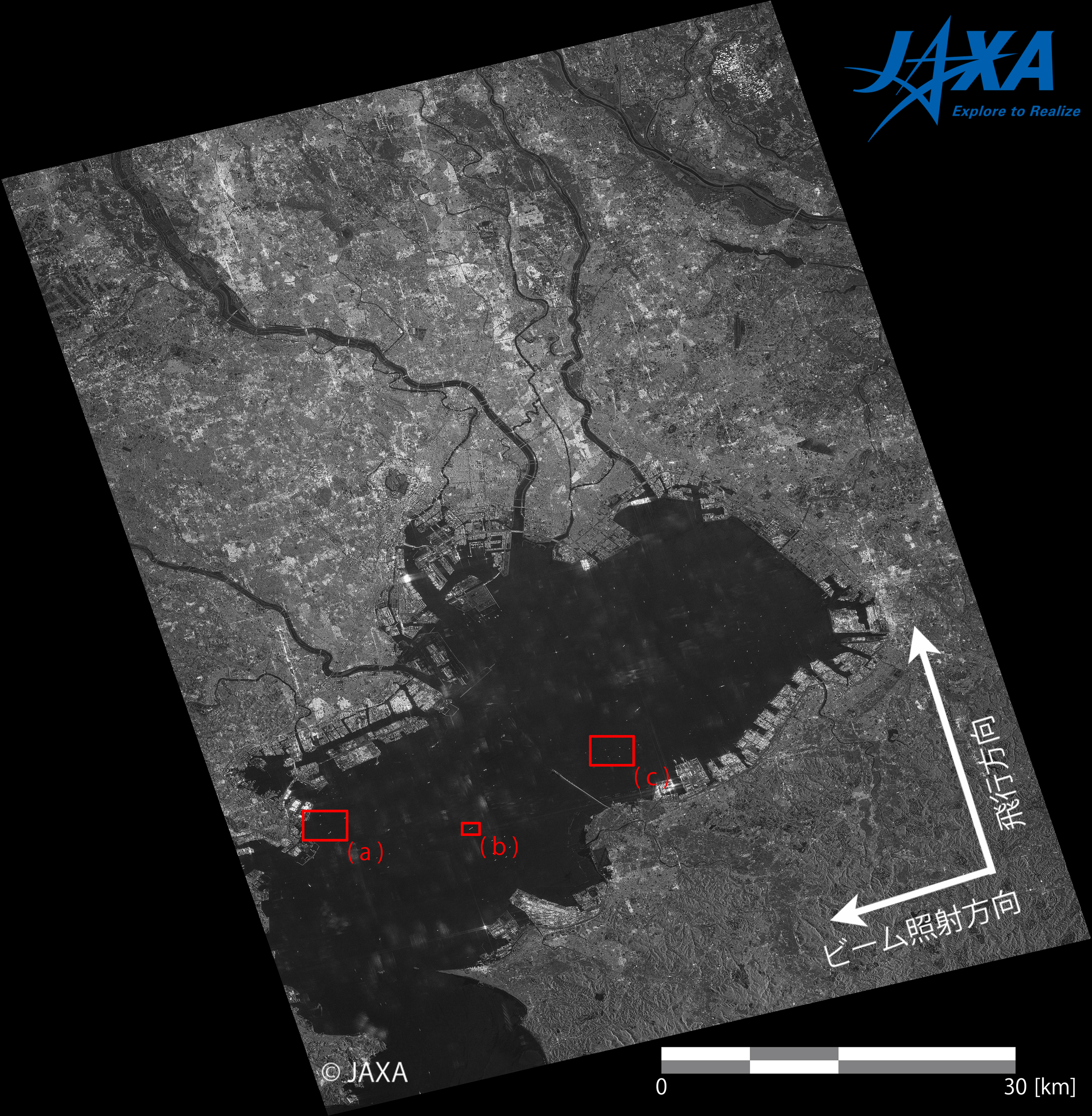
Tokyo bay was observed by using the Stripmap Ultrafine mode (3 m resolution) of PALSAR-2 in August 29, 2014 (JST). Figure 1, 2, and 3 show the observation area, the PALSAR-2 image, and examples of identified ships, respectively.
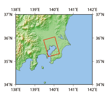 Figure 1. Observation area (Tokyo Bay; digital elevation model: GTOPO30)
(Click the image for enlarge view)
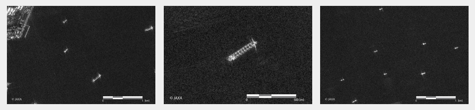
(The left, center, and right images are from the red boxes (a), (b), and (c) in Figure 2, respectively.)
(Click the image for enlarge view)
The highly spatial resolution of 3 m enables us to know movement direction and detailed shape of ships. For example, the ship in the center image of Figure 3 is estimated to be a bulk carrier due to its characteristic shape. The square pattern on the ship corresponds to loading hatches. Thus, the PALSAR-2 can obtain images covering a wide area with high resolution at once, which can be used to identify the type of ships.
2. Singapore Straits
Singapore Straits was observed using the Stripmap Fine mode (10 m resolution) of PALSAR-2 in July 4, 2014 (JST). Figure 4, 5, and 6 show the observation area, the PALSAR-2 image, and examples of identified ships, respectively.
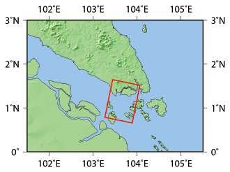 Figure 4. Observation area (Singapore Straits; digital elevation model: GTOPO30)
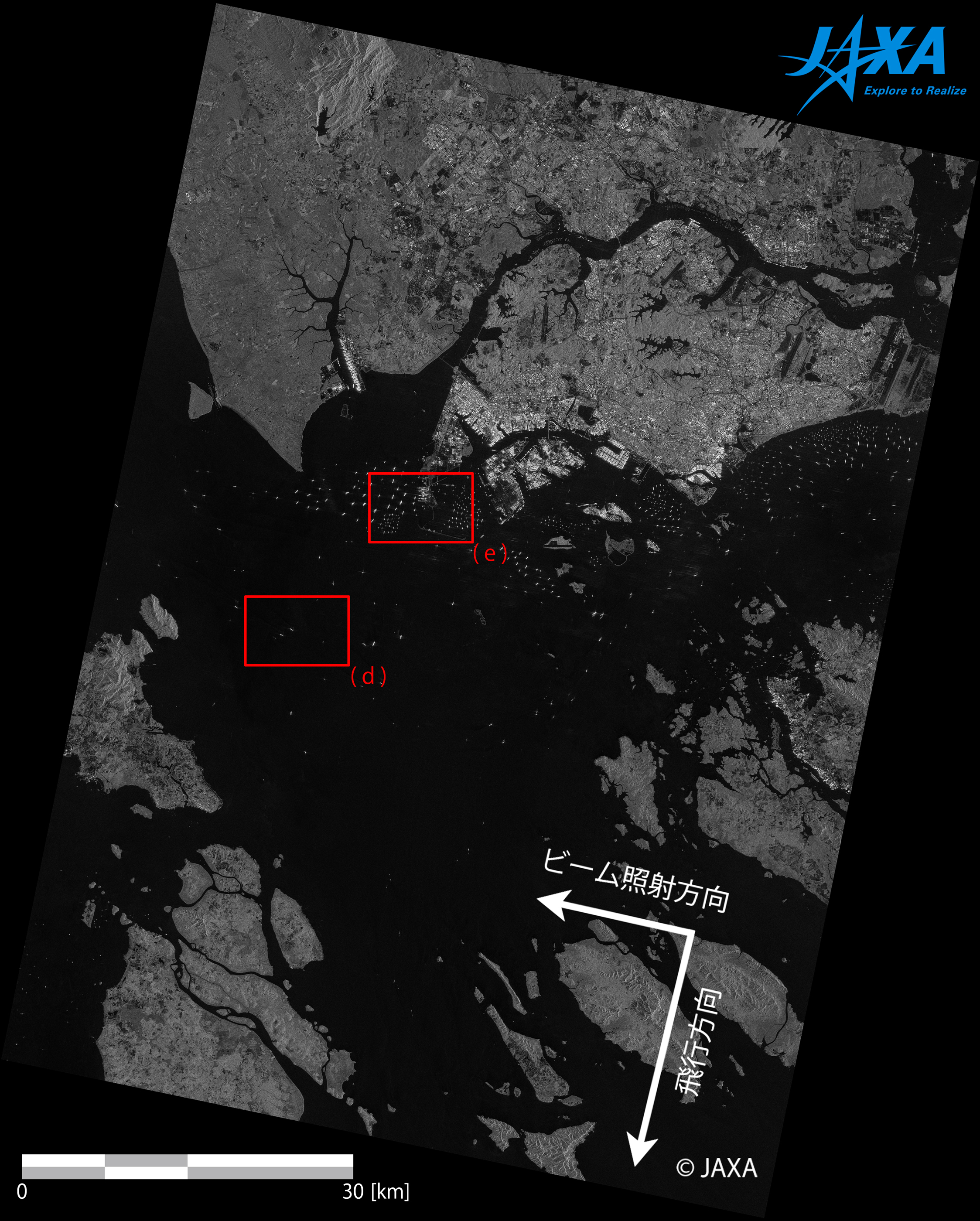 Figure 5. PALSAR-2 image over Singapore Strait
(Click the image for enlarge view)

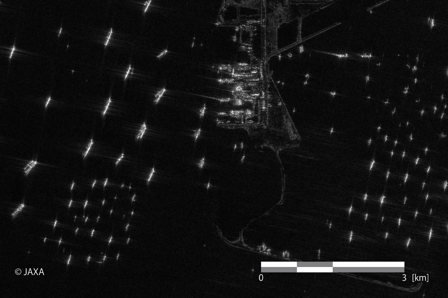
The left and right images are from the red boxes (d) and (e), respectively.
(Click the image for enlarge view)
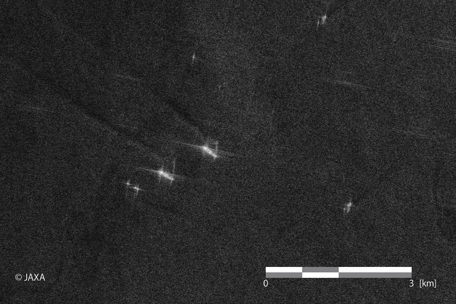 Figure 7. Image corrected the brightness of the left image of Figure 6
(Click the image for enlarge view)
The Fine mode (10 m resolution) can cover a wider swath than the Ultrafine mode (3 m resolution). The swath of the image is approximately 70 km.
The PALSAR-2 image (the right image of Figure 6) can show a lot of ships anchored outside of the port of Singapore before/after sailing through the Strait of Malacca. As shown in Figure 7, ship wakes are also appeared in the image. In synthetic aperture radar (SAR) images, ships moving to the observing SAR are displaced from their wakes in the positive direction of satellite moving. It is because Doppler frequency caused by relative movements between the SAR and the ships is positively shifted compared to other targets such as ocean surfaces. Conversely, ships moving away from the SAR are displaced from their wakes in the opposite direction of satellite moving.
3. off the coast of Kii Peninsula
Off the coast of Kii Peninsula was observed using the ScanSAR mode of PALSAR-2 in September 1, 2014 (JST). Figure 8, 9, and 10 show the observation area, the PALSAR-2 image, and examples of identified ships, respectively.
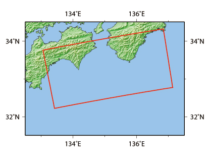 Figure 8. Observation area (Kii Peninsula; digital elevation model: GTOPO30)
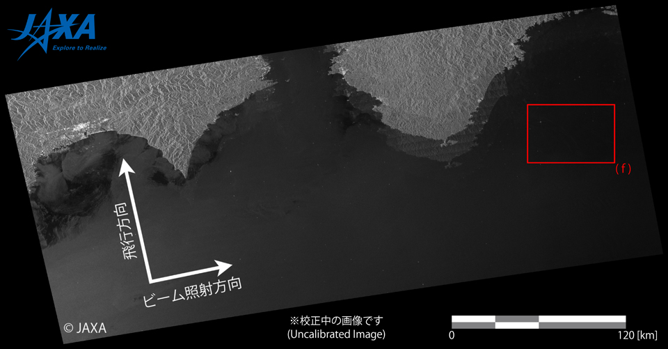 Figure 9. PALSAR-2 image over off the coast of Kii Peninsula
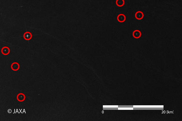 Figure 10. Identified ships in the red box (f) in Figure 9
The bright points with red circles are estimated to be ships.
The spatial resolution of the ScanSAR mode is approximately 100 m, which can capture large-size ships as bright points. The ScanSAR mode can cover 350 km swath width.
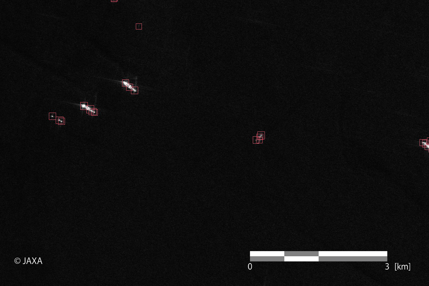
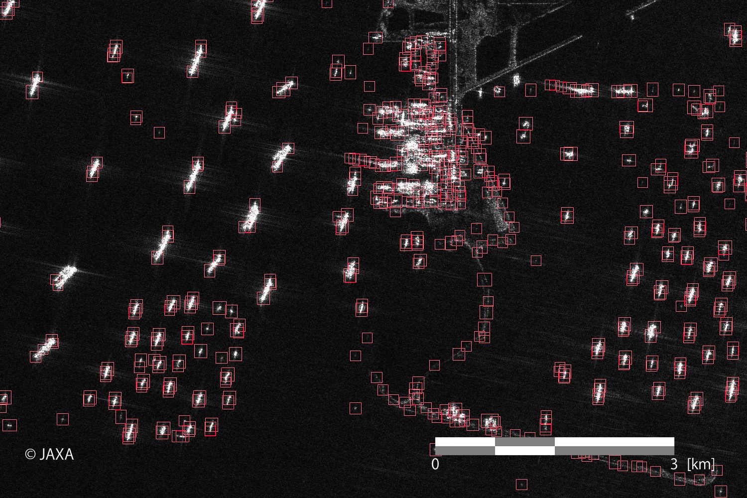
4. Automatic ship detection
JAXA/EORC is developing algorithms to detect ships in PALSAR-2 images automatically. Preliminary results are shown in Figure 11. The red boxes were automatically attached to the image, which mean identified ships.
(Click the image for enlarge view)
As shown above, the PALSAR-2 can obtain wide-swath and high-resolution images containing ship information regardless of weather conditions and day/night. Various needs can be satisfied by utilizing different characteristics of each observation mode.
One of further applications of PALSAR-2 images to marine monitoring is more detailed information extraction by combining SAR-based ship detection results and AIS data*2.
*2: AIS (Automatic Identification System) is a system transmitting vessel information such as position. In Japan, ships beyond a certain size are required to install the AIS.
Reference:
© JAXA EORC
© Copyright 1997- All Rights Reserved.