
Observation Results for Eruption of Shinmoedake by ALOS-2 and COSMO-SkyMed
Posted: Mar. 26, 2018, 9:00 (UTC)
Overviews
- On March 1, 2018, Shinmoedake in southern Kyusyu, Japan began eruptive activity.
- JAXA has performed an emergency observation with the Phased Array Type L-band Synthetic Aperture Radar-2 (PALSAR-2) aboard Advanced Land Observing Satellite-2 (ALOS-2, “DAICHI-2”) since March 6, 2018. The ALOS-2 images revealed development of a lava dome in the crater.
- COSMO-SkyMed also observed the enlargement of the lava dome more clearly and detected the lava movement.
- The observation image on March 19 shows that the lava which flowed out to outside the crater still flows and the developing speed of the lava dome of crater inside has been decreasing.
- We will contentious observe there to monitor volcanic activities using ALOS-2 which can observe earth surface regardless of clouds, volcanic plumes, and sun light.
JAXA was requested from Japan Meteorological Agency to perform an emergency observation with the Phased Array Type L-band Synthetic Aperture Radar-2 (PALSAR-2) aboard Advanced Land Observing Satellite-2 (ALOS-2, “DAICHI-2”) since March 6 2018, and the observed data are provided to related institutions. Moreover, JAXA requested ASI (Agenzia Spaziale Italiana, Italian Space Agency) to perform an emergency observation by COSMO-SkyMed and was provided the data. The datasets of ALOS-2 and COSMO-SkyMed are listed in Table 1 and Table 2.
| Observation time(UTC) | Orbital No. | Mode | Orbit | Direction | Beam No. | |
| (1) | 3:18, Jan. 22, 2018 | 23 | Stripmap | Des. | Right | U2-7 | (2) | 3:18, Mar. 5, 2018 | 23 | Stripmap | Des. | Right | U2-7 | (3) | 14:30, Mar. 6, 2018 | 124 | Stripmap | Asc. | Left | U3-11 | (4) | 3:04, Mar. 9, 2018 | 21 | Stripmap | Des. | Right | U3-13 | (5) | 3:25, Mar. 10, 2018 | 24 | Spotlight | Des. | Right | - | (6) | 14:16, Mar. 10, 2018 | 122 | Spotlight | Asc. | Left | - | (7) | 14:36, Mar. 11, 2018 | 125 | Stripmap | Asc. | Left | U2-8 | (8) | 3:11, Mar. 14, 2018 | 22 | Stripmap | Des. | Right | U3-10 | (9) | 14:23, Mar. 15, 2018 | 123 | Stripmap | Asc. | Left | U3-14 |
| Observation time(UTC) | Mode | Orbit | Direction | Beam ID | Satellite No. | |
| (1) | 20:12, Mar. 7, 2018 | Spotlight | Asc. | Left | 24 | S2 | (2) | 8:53, Mar. 8, 2018 | Spotlight | Des. | Right | 23 | S1 | (3) | 21:12, Mar. 9, 2018 | Spotlight | Asc. | Right | 27 | S4 | (4) | 22:56, Mar. 10, 2018 | Spotlight | Asc. | Left | 17 | S1 | (5) | 8:59, Mar. 11, 2018 | Spotlight | Des. | Right | 16 | S2 | (6) | 8:59, Mar. 12, 2018 | Spotlight | Des. | Right | 16 | S3 | (7) | 8:59, Mar. 15, 2018 | Spotlight | Des. | Right | 16 | S4 | (8) | 8:59, Mar. 19, 2018 | Spotlight | Des. | Right | 16 | S1 |
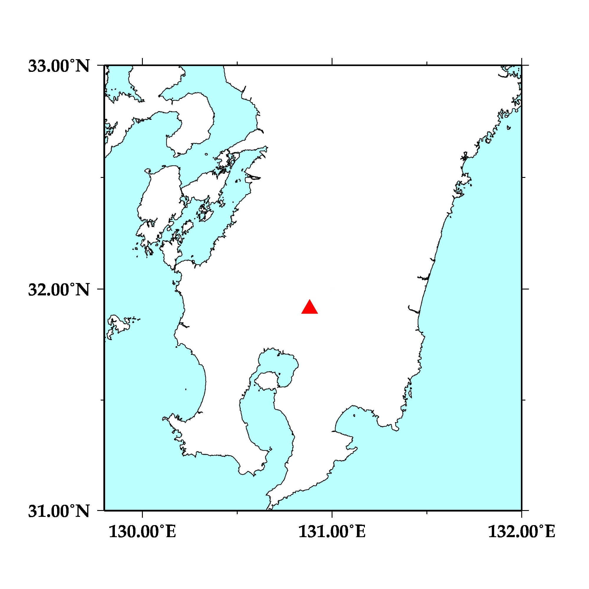 Fig. 1: Map of southern Kyusyu, Japan. The red triangle shows the location of Shinmoedake.

(Click to view enlarged image)
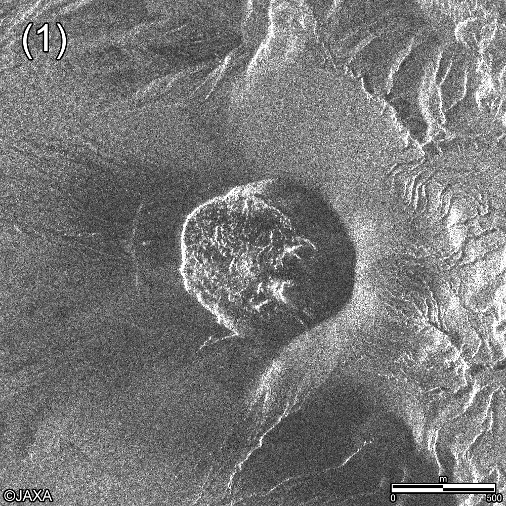
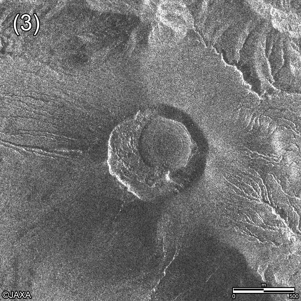
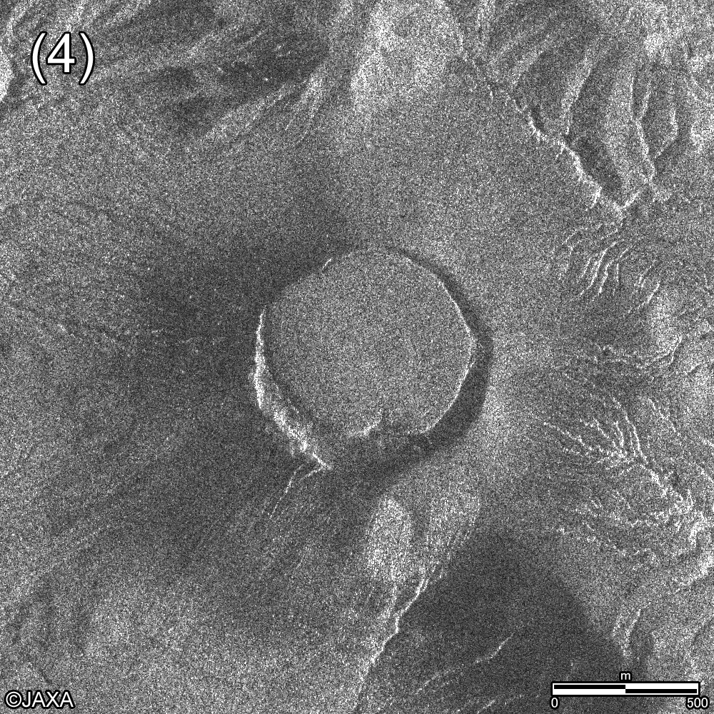
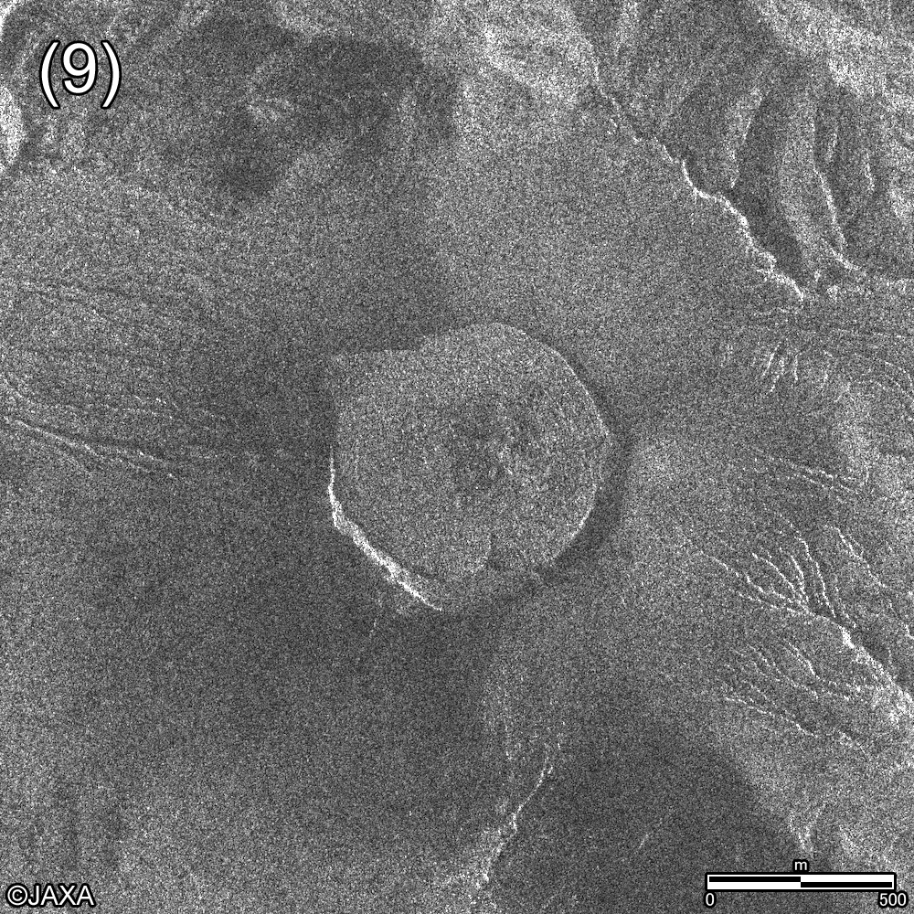
Figure 2 shows the observation images around the crater of Shinmoedake by ALOS-2. These images were acquired from eastern side of Shinmoedake. Comparing with the image on (1) Jan. 22, we confirmed some changes in the crater in the image on (2) Mar. 5, and a lava dome was formed on (3) Mar. 6. The dome had enlarged time by time, and the lava flowed out to the northwest direction on (5) Mar. 10. The dome continued to get larger and it covered almost all of the crater on (9) Mar. 15. You can see how the dome has been developed by animation on Fig. 3.


(Click to view enlarged image)
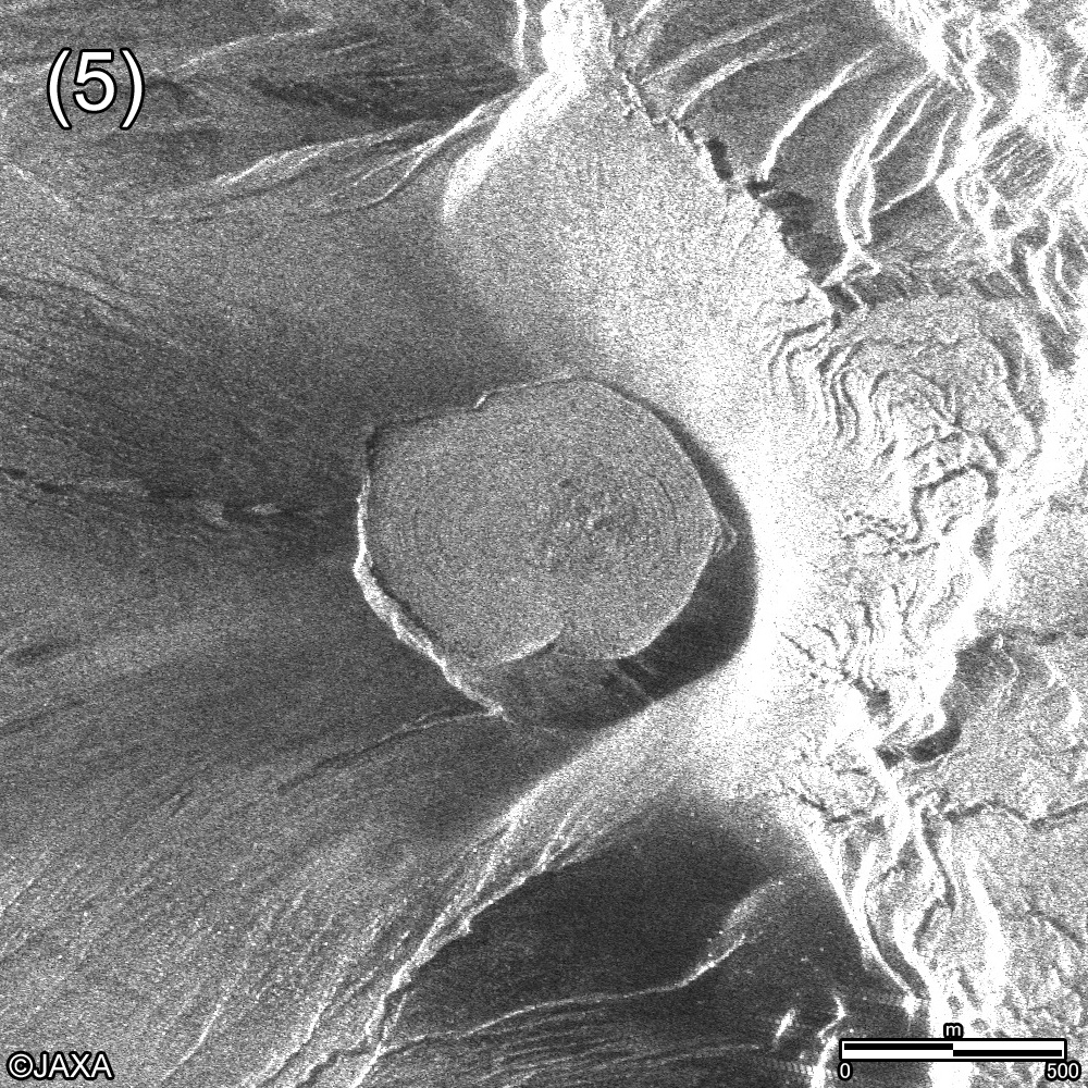
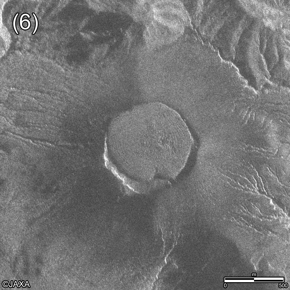
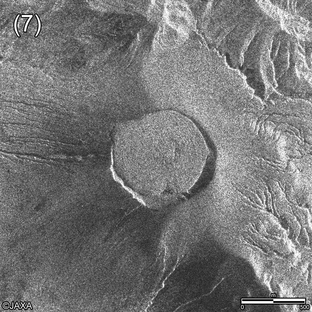
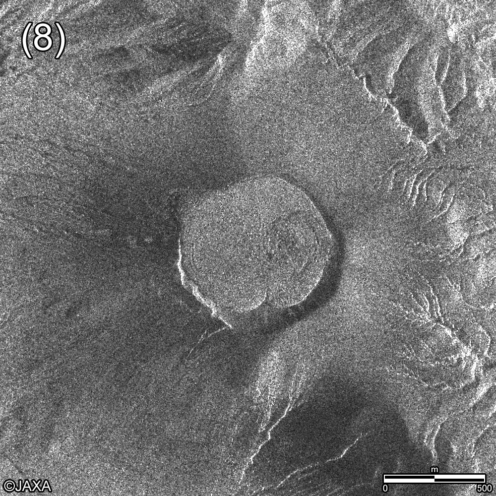
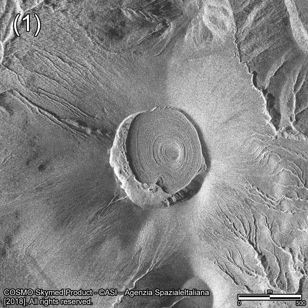
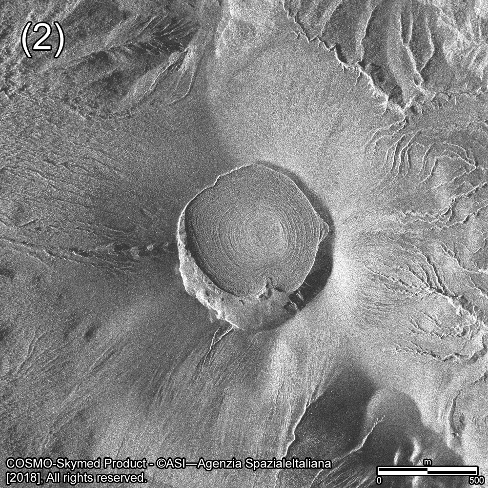
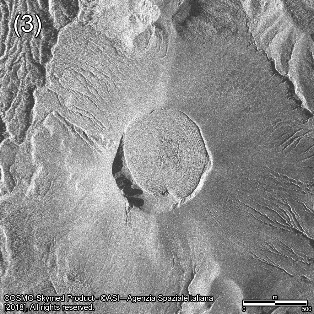
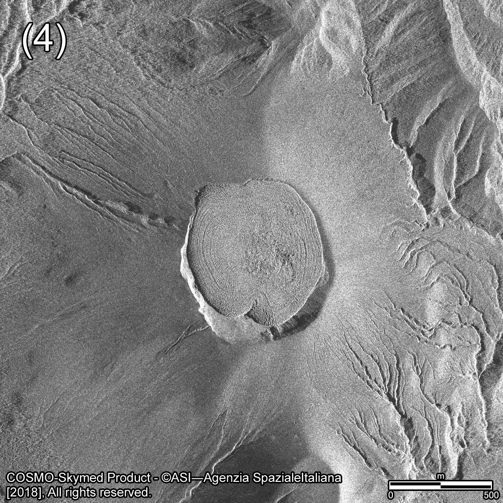
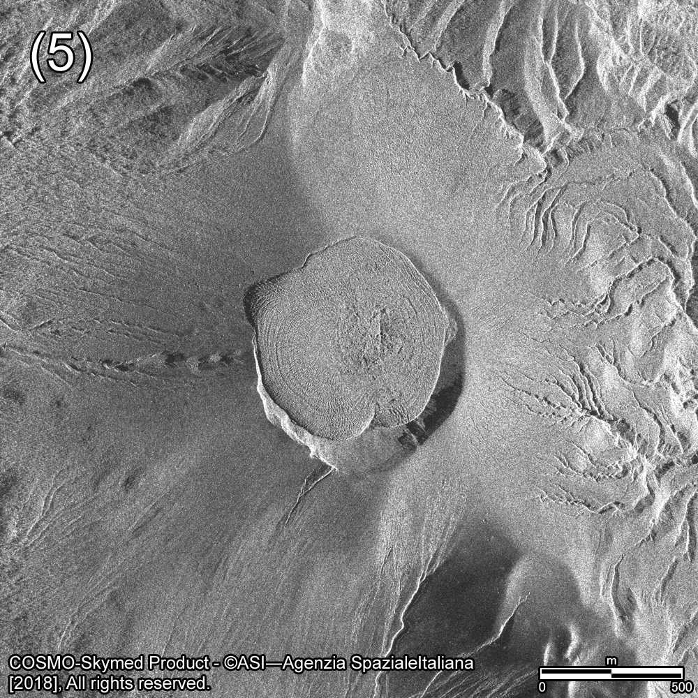
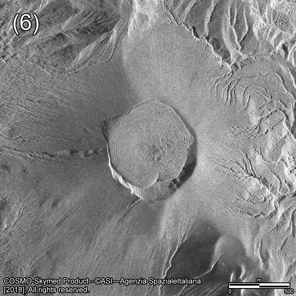
Figure 4 shows the observation images around the crater of Shinmoedake by COSMO-SkyMed. COSMO-SkyMed uses X-band microwave (wavelength: 3.1 cm) and we can clearly recognize the outline of the lava dome and the surface striped patterns. Comparing observation image on March 15 with that on March 19, we confirm the lava which flowed out into crater outside still flows and the lava dome has been enlarging. Fig. 5 is an animation composed of the latest three COSMO-SkyMed images. You can see the enlargement of lava done more clearly.
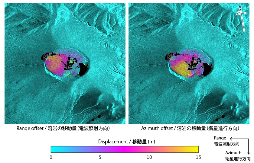 Fig. 6: Lava movement derived from COSMO-SkyMed images obtained on Mar. 11 and Mar.12 using pixel offset technique. Left figure shows the displacement along the range direction. Right figure is that along the azimuth direction.
Figure 6 shows the lava movement in the crater derived from pixel offset (or offset tracking) technique. The pixel offset is a robust method to detect localized large displacement at precise coregistration of two images. Applying this method to COSMO-SkyMed images acquired on Mar. 11 and Mar. 12, approx. 12 m along range (i.e. west) direction and approx. 15 m along azimuth (i.e. south) direction were detected. This movement is recognized in the animation in Fig. 5.
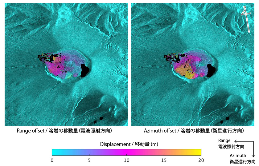 Fig. 7: Lava movement derived from COSMO-SkyMed images obtained on Mar. 15 and Mar.19 using pixel offset technique. Left figure shows the displacement along the range direction. Right figure is that along the azimuth direction.
Figure 7 also shows the lava movement derived from COSMO-SkyMed images acquired on Mar. 15 and Mar. 19. Approx. 15 m along range (west) direction and approx. 20 m along azimuth (south) direction were detected during four days, indicating the developing rate of the lava dome has been decreasing.
We will continue to monitor Shinmoedake by ALOS-2.
© JAXA EORC
© Copyright 1997- All Rights Reserved.