
ALOS-2/PALSAR-2 Observation Results of Mt. Shindake Volcano,
Kuchinoerabu-jima Island
The Japan Aerospace Exploration Agency (JAXA) observed Mt. Shindake volcano, Kuchinoerabu-jima Island with
the Advanced Land Observing Satellite-2 "DAICHI-2" (ALOS-2)/ the Phased Array Type L-band Synthetic Aperture Radar type 2 (PALSAR-2) on August 7 0:38(JST).
Figure 1 shows the observation area of PALSAR-2 (Red frame) and the orbital path of ALOS-2 (Blue line).
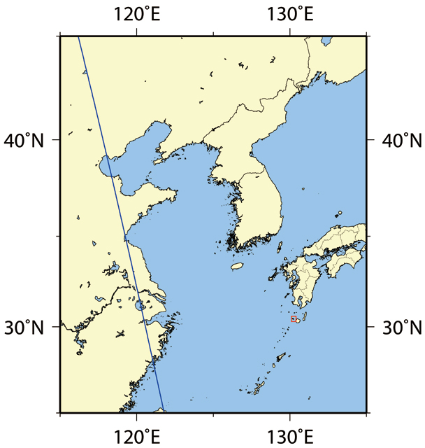 Fig.1: Observation area (Kuchinoerabu-jima island, Kagoshima) and the satellite path
(Click to view enlarged image)
(Click to view enlarged image)
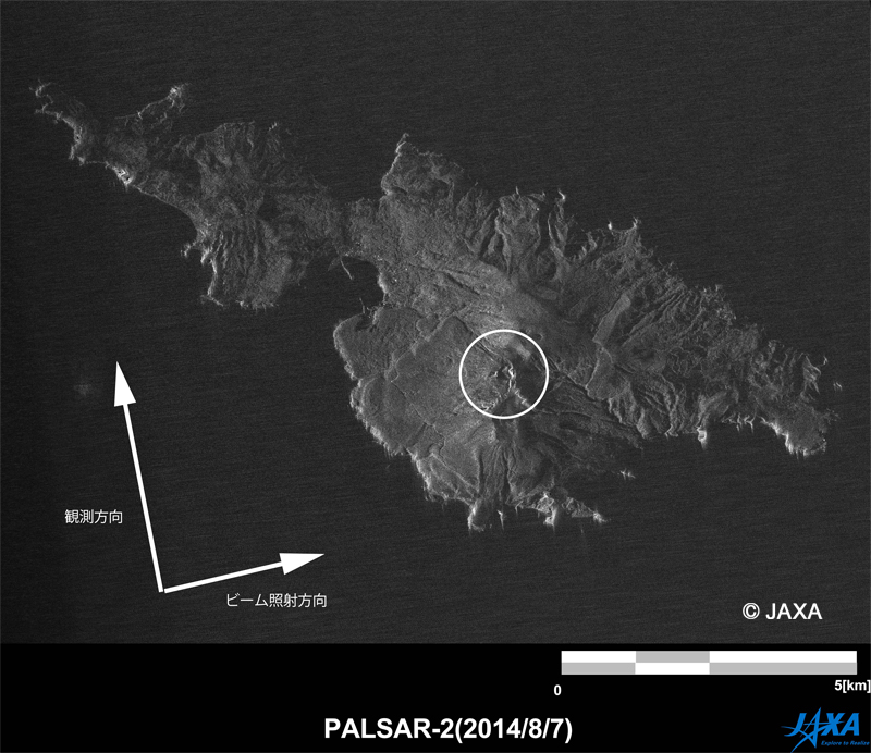
Figure 2 shows the Kuchinoerabu-jima island observed in Stripmap [3m] mode (single polarization). The circled part in the figure is the Mt. Shindake which erupted.
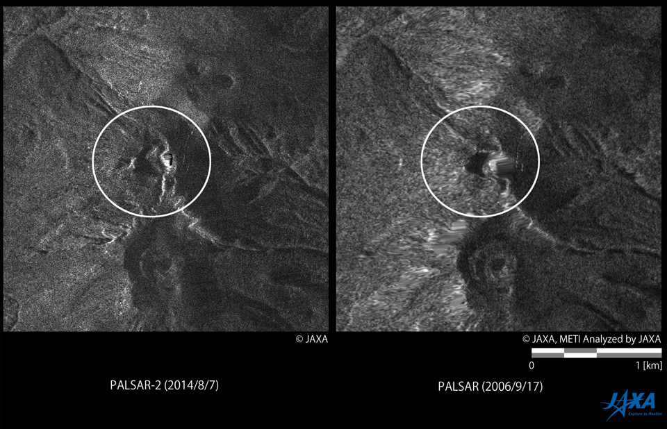
Left: ALOS-2/PALSAR-2 image (HH polarization). Right: ALOS/PALSAR image (HH polarization)
(Click to view enlarged image)
Figure 3 shows the ALOS-2/PALSAR-2 image (Off-nadir angle 53.3 deg.) and ALOS/PALSAR image observed in Sep. 17, 2006 (Off-nadir angle 41.5 deg.).
Both images are orthorectified. Circled part is the Mt. Shindake that erupted.
JAXA has provided those observed PALSAR-2 images to the municipal agencies. JAXA will continue the observation and analysis at this area.
© JAXA EORC
© Copyright 1997- All Rights Reserved.