
ALOS-2/PALSAR-2 Observation Results of Mt. Calbuco Volcano eruption in Chile
The Japan Aerospace Exploration Agency (JAXA) observed Mt. Calbuco volcano in Chile with Phased Array Type L-band Synthetic Aperture Radar 2 (PALSAR-2) aboard Advanced Land Observing Satellite 2 (ALOS-2, "DAICHI-2") satellite on April 25, 2015, 1:48 (local time; GMT-4). The volcano erupted during April 22 to 23, 2015 (local time).
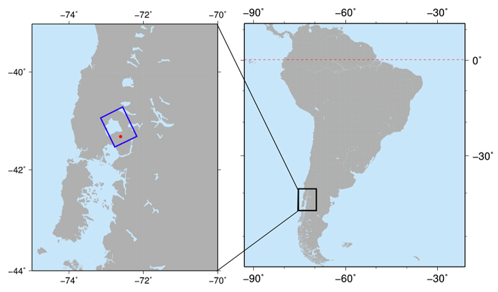 Fig.1: Observation area of the PALSAR-2 observation for Mt. Calbuco volcano on April 25, 2015.
The red point and the blue box illustrate the location of Mt. Calbuco volcano and
the observation area of PALSAR-2, respectively.
Figure 2 shows the overall image obtained by the PALSAR-2 high-resolution mode (3 m resolution, dual polarizations). The color composite in the image represents HH polarization in red, HV polarization in green, and HH/HV in blue. Different color in the image indicates different backscattering signals from the ground. Generally, dark blue color shows water or bare land and green color shows volume scattering such as vegetation cover. The red box at the bottom of image shows location of the Mt. Calbuco volcano area.
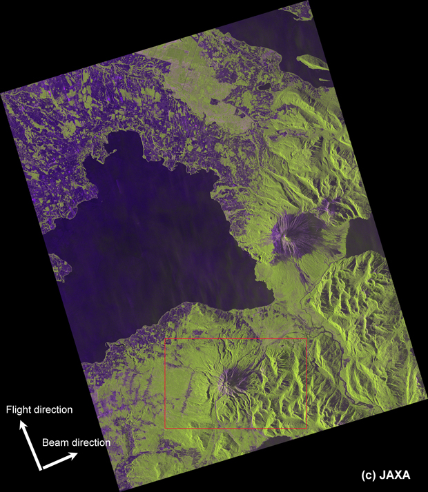
(Click to view enlarged image)
Figure 3 compares the volcano area image extracted from the Figure 2 with the image obtained by PALSAR-2 image at 10 m resolution mode on March 4, 2015. Note that the tilt of the mountain features is different because of different observation angles between observations. Dark color regions expanded at the northeast area of the mountain top (red circle) after the eruption suggests that the ground surface condition of the area changed due to volcanic ash or lahar (mud flow).
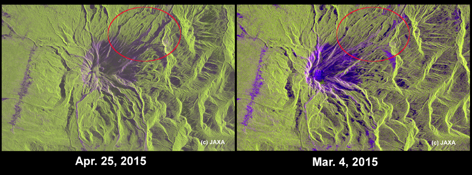
Left: observation with 3 m resolution mode (beam: U3-11, off-nadir angle: 42.7 degree) on April 25, 2015.
Right: observation with 10 m resolution mode (beam: F2-5, off-nadir angle: 28.2 degree) on March 4, 2015.
(Click to view enlarged image)
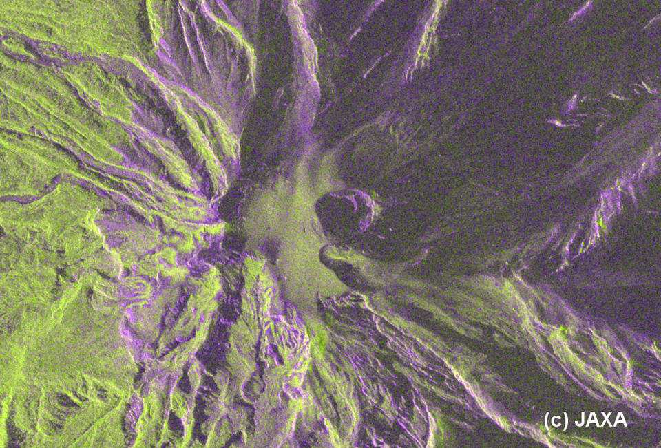
Figure 4 shows an enlarged image around the craters of the Mt. Calbuco volcano. Two craters at the center of the image, from which ash plume is evolving according to other information sources such as photos, can be clearly observed. The image also shows several small holes at the western side of the craters which are considered as gas vents. Although it is difficult to extract detailed changes around the craters due to unavailability of images acquired with high resolution before the eruption, the PALSAR-2 images can show the volcanic crater even it is covered with smokes and clouds indicating great potentials for volcano monitoring.
JAXA will continue the observation and analysis at this area and will provide PALSAR-2 images and results to relevant organizations and this website.
© JAXA EORC
© Copyright 1997- All Rights Reserved.