
ALOS-2/PALSAR-2 Observation Results on Wildfire in Canada
Responding to an emergency observation requests from the International Charter of Space and Major Disasters, the Japan Aerospace Exploration Agency (JAXA) performed an emergency observation for the wildfire in Canada by means of the Phased Array type L-band Synthetic Aperture Radar-2 (PALSAR-2) aboard the Advanced Land Observing Satellite-2 (ALOS-2, "DAICHI-2") on May 9, 2016.
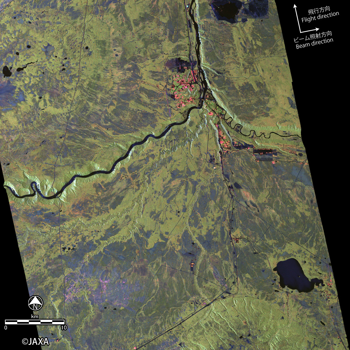
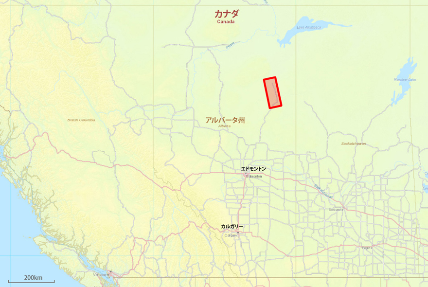 Fig.1 : Area of the PALSAR-2 observation on May 9, 2016
* Drag a slider over the image or click an arbitrary position in the images to compare the images.
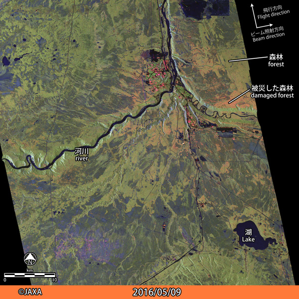
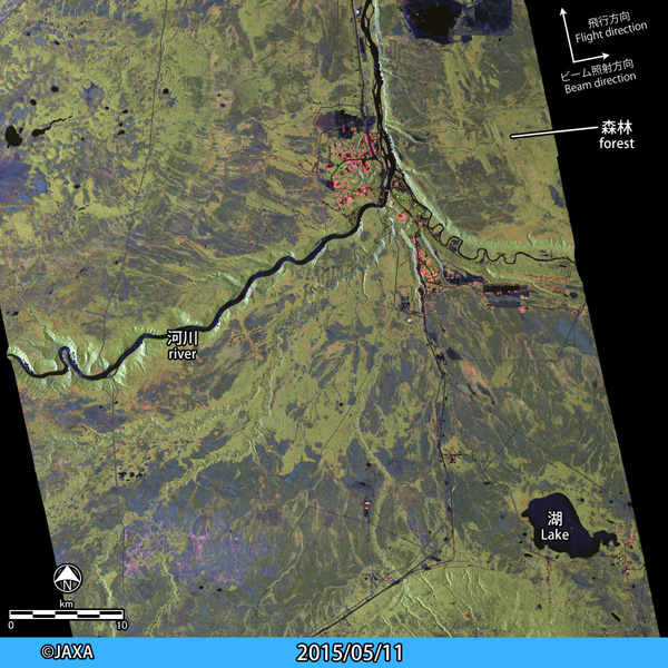
Fig. 1 shows the area of the observation on May 9, 2016. Figure 2 is an interactive image comparison between post-disaster (May 9, 2016) and pre-disaster (May 11, 2015). Both data were acquired by high-resolution (6m) fully-polarimetric mode, and the images are pseudo-color composite of red: HH-VV, green: HV and blue: HH+VV polarization. Damaged areas changed from green to red in the images probably due to a change of scattering mechanism caused by the wildfire.
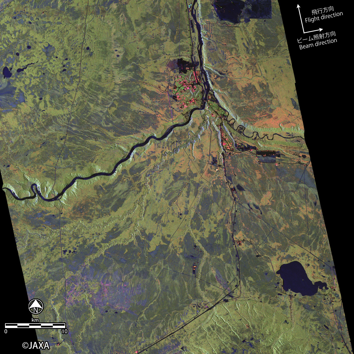
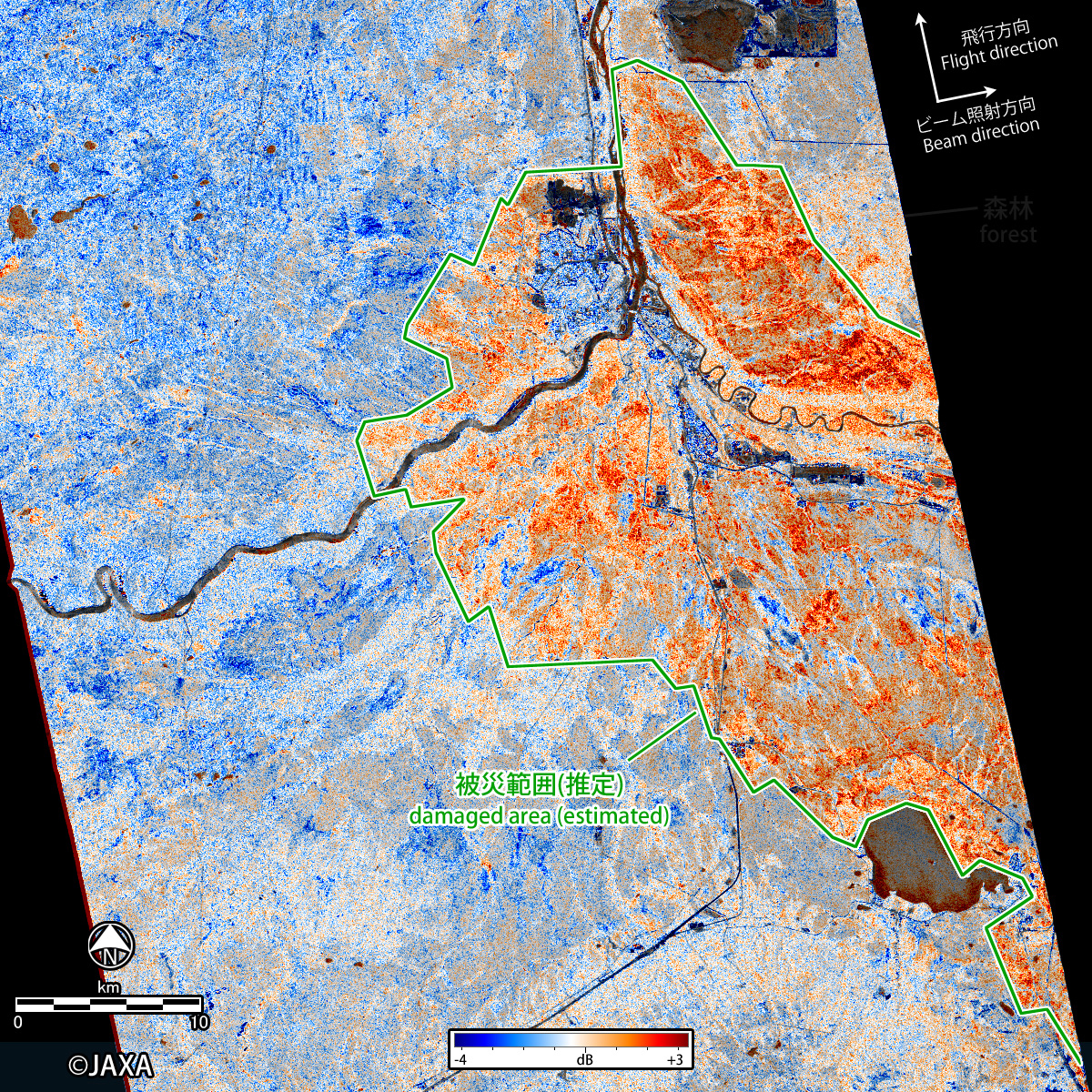
Fig. 3 is a difference image of HH-VV polarization, which describes change of double-bounce scattering. Red color in this image represents increase of HH-VV scattering and roughly corresponding to damaged forest area.
(Click to view enlarged image)
© JAXA EORC
© Copyright 1997- All Rights Reserved.